Tomorrow, an arctic cold front will work through the region, arriving at the I81 corridor around 9/10am & 1pm along the Bay. This will usher in 20s/30s to the area, which may allow any rain to briefly turn to a quick burst of snow. The snow could be briefly heavy w/ low visibility.
This should not put down much snow at all. Our Cedar Point Federal Credit Union Futurecast model is the most aggressive that I’ve seen with this & even this is just a quick coating on grassy areas.
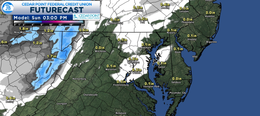
Driving might be temporarily hazardous w/ low visibility, but no road accumulations. This lasts for about 30mins.
John Bordash
View More PostsJB Weather forecaster John Bordash is working around the clock to provide Southern Maryland, and neighboring communities, with accurate and reliable weather information.