Limited melting today, combined with steadily falling temperatures, is setting the stage for a cold and potentially icy night across the region, even without much additional snowfall.
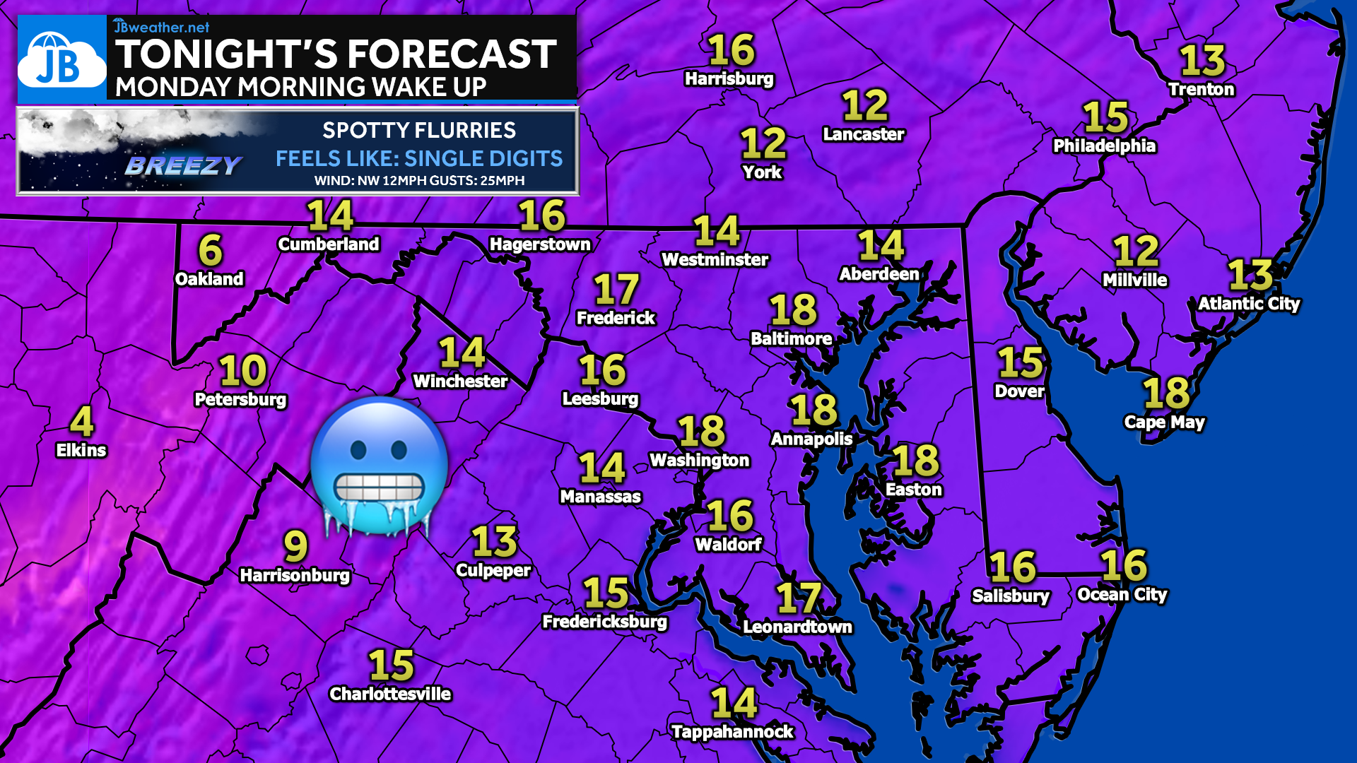
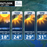
Overnight lows fall into the teens, with wind chills dropping into the single digits due to a persistent northwest breeze. Skies remain mostly cloudy, and spotty flurries are possible overnight, especially in areas exposed to northwest flow. Temperatures will be slow to rebound Monday morning, keeping surfaces cold well into the early commute.
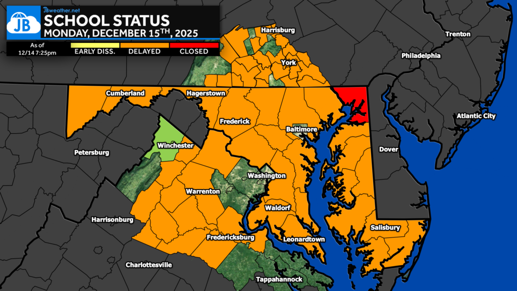
Many school districts are opting for delays Monday morning, not because of new snow, but due to black ice concerns and dangerously cold temperatures. With limited melting during the day and rapid refreezing tonight, untreated roads and walkways may be slick during the early morning hours. Stay up to date on closings and delays, here: https://jbweather.net/closings/
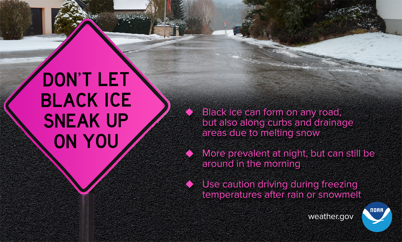
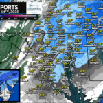
Black ice may be present on untreated roads, bridges, shaded areas, and near curbs or drainage spots. Even surfaces that appear wet can be slippery — use caution and allow extra time if traveling overnight or early Monday morning.
Stay with JB Weather for the latest information on impacts here in Southern Maryland and across the Mid-Atlantic. You can always access my forecasts and updates here on the website, on Facebook, on Twitter, on Instagram, and on YouTube. JB Weather is the Mid-Atlantic’s Weather Leader, and I am working around the clock to keep you ahead of any storm!
John Bordash
View More PostsJB Weather forecaster John Bordash is working around the clock to provide Southern Maryland, and neighboring communities, with accurate and reliable weather information.