Brought to you by Sonder Studios
We continue to monitor a potential winter weather event for this weekend, with forecast confidence slowly increasing that a system will move east across the southern U.S. and toward the East Coast. While this remains a multi-day forecast challenge, trends continue to suggest that parts of the Mid-Atlantic could see winter weather impacts, particularly as we head into Sunday.
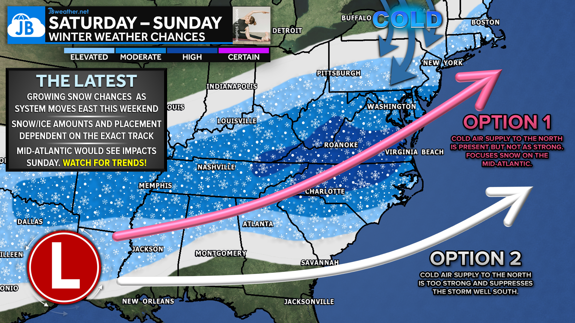
The overall pattern has not changed significantly since yesterday, but details within that pattern are still being refined. As shown in the graphic, cold air remains firmly in place to the north, while a developing storm system attempts to move east and then north along the coast. The key question continues to be how strong that cold air supply is, and whether it suppresses the storm south or allows it to track farther north, increasing winter weather chances locally.
European Model: Northern Track Scenario
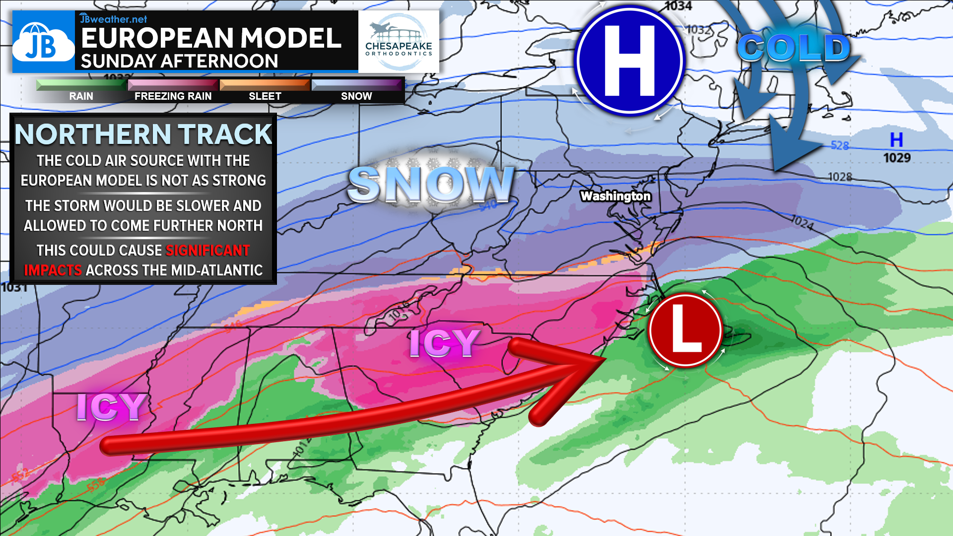
The latest European model continues to favor a weaker cold air source to the north, allowing the storm to slow down, strengthen, and track farther north along the coast. In this scenario, the Mid-Atlantic would fall into a higher-impact zone, with snow on the northern side of the storm and a notable ice or mixed-precipitation region closer to the storm track. This solution would support significant winter weather impacts, though exact snow and ice amounts would still be highly sensitive to small track shifts.
American Model: Southern Track Scenario
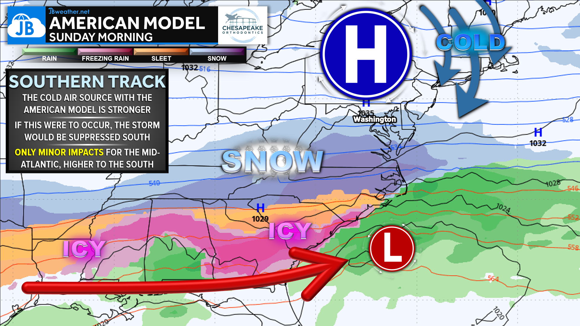
The American model (GFS) remains the most aggressive with strong arctic high pressure to the north, which acts to suppress the storm farther south. If this solution verifies, the bulk of winter weather impacts would remain focused across the Southeast, with the Mid-Atlantic seeing only minor or limited impacts, despite cold air being in place. This outcome remains plausible, especially if the northern high pressure proves too strong.
Timing Trends
One area where guidance is beginning to show better agreement is timing. Current trends suggest that Sunday may be the primary window for winter weather impacts, particularly if the storm continues to slow down as it approaches the coast. Should the system be allowed to come farther north and linger offshore, some impacts could extend into Monday, though confidence in that remains low at this time.
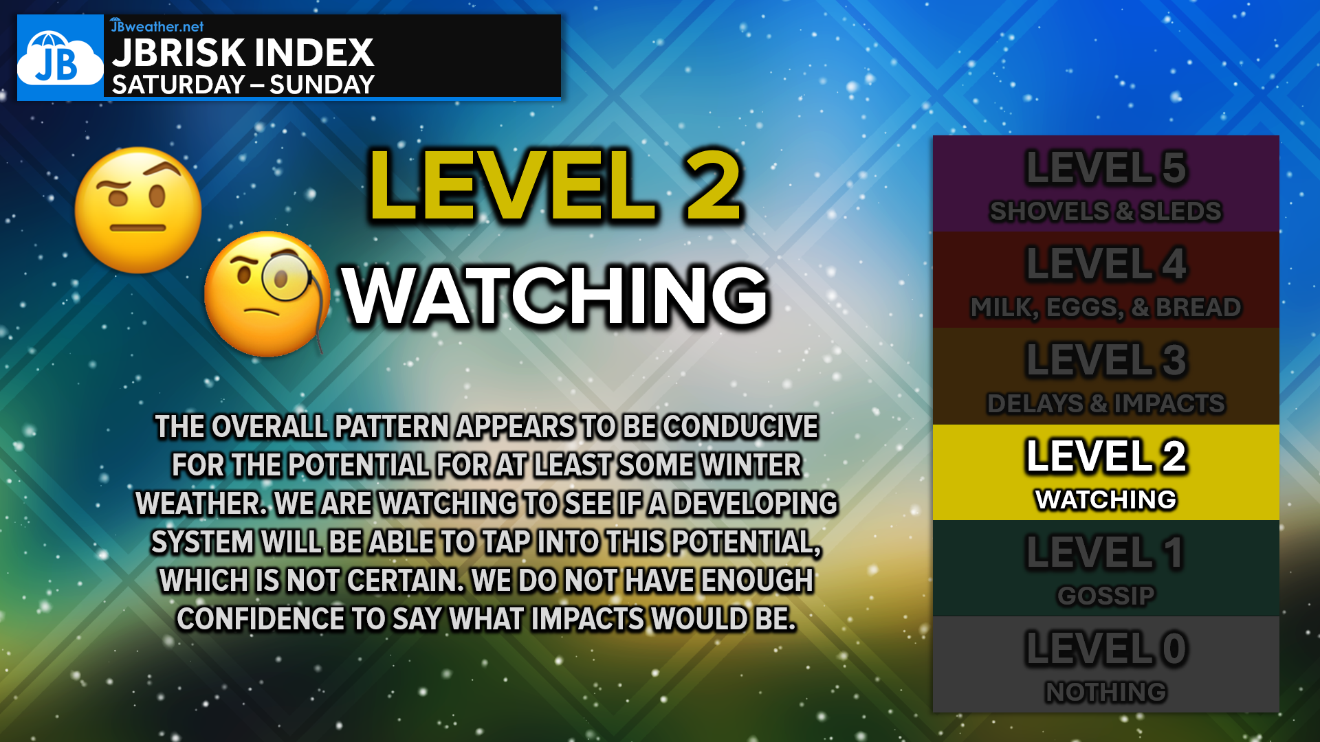
This forecast remains highly track-dependent, and it is still too early to lock in snowfall or ice amounts. While confidence is growing that a storm will exist, the strength of arctic high pressure to the north will ultimately decide how far north the storm tracks and how impactful it becomes locally. These are details that are rarely resolved this far in advance, so continued forecast adjustments are expected. We’ll continue watching trends closely and provide updates as confidence improves.
Stay with JB Weather for the latest information on impacts here in Southern Maryland and across the Mid-Atlantic. You can always access my forecasts and updates here on the website, on Facebook, on Twitter, on Instagram, and on YouTube. JB Weather is the Mid-Atlantic’s Weather Leader, and I am working around the clock to keep you ahead of any storm!

SONDER STUDIOS® is home to Yoga, Pilates, Barre, and Strength classes in Calvert County. Wellness is our business, and belonging is at the heart of our culture. We are grateful for your trust for 6+ years. Sign up for an intro week at www.sonderstudios.us
John Bordash
View More PostsJB Weather forecaster John Bordash is working around the clock to provide Southern Maryland, and neighboring communities, with accurate and reliable weather information.