Brought to you by Bill Oosterink, Realtor
Good morning! Forecast modeling continues to highlight the potential for a winter storm this weekend, though there are still key disagreements on the exact placement of arctic high pressure to the north and the eventual storm track. Those details will play a major role in precipitation type, impacts, and amounts across the region.
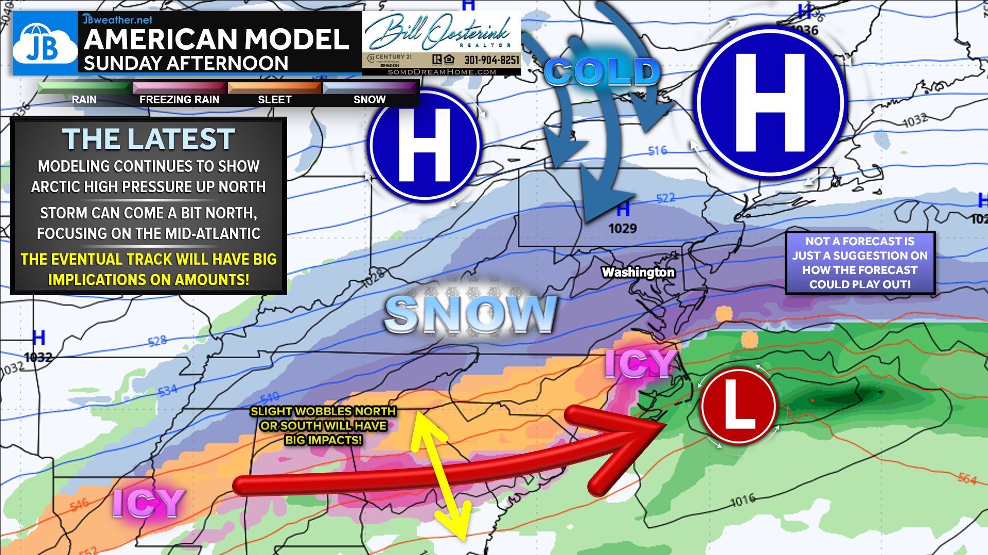
What is becoming clearer is that the system may be more focused on Sunday, especially if the storm continues to slow down, with the potential for lingering impacts into Monday should it be allowed to track farther up the coast. It’s important to remember that we rarely have these details locked in this early — this forecast will continue to shift and evolve, and we’ll keep you updated as confidence improves.
Below is a videocast from last night detailing the potential
Stay with JB Weather for the latest information on impacts here in Southern Maryland and across the Mid-Atlantic. You can always access my forecasts and updates here on the website, on Facebook, on Twitter, on Instagram, and on YouTube. JB Weather is the Mid-Atlantic’s Weather Leader, and I am working around the clock to keep you ahead of any storm!
Buying. Selling. Investing. Ready when you’re ready! Check out www.somdDreamHome.com today!
John Bordash
View More PostsJB Weather forecaster John Bordash is working around the clock to provide Southern Maryland, and neighboring communities, with accurate and reliable weather information.
1 thought on “Weekend Winter Storm Still on the Radar”
Comments are closed.
thank you for giving us up to date information without the hype. been a fan since the beginning, used to live in Scotland but moved up into Baltimore, you are still my go to weather info person.