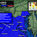
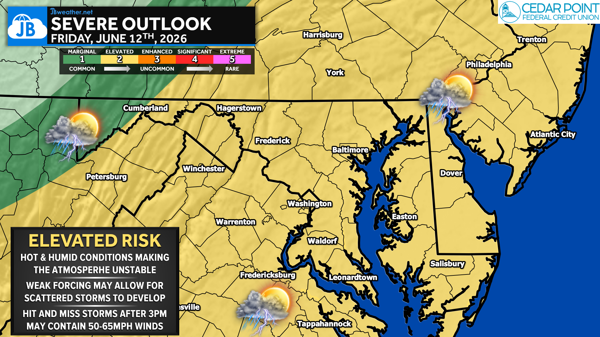
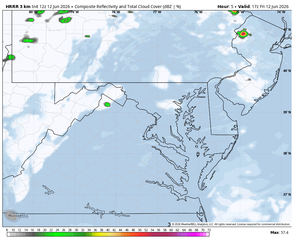
After back-to-back days of hot and humid conditions, the threat for strong to severe thunderstorms will continue across the Mid-Atlantic on Friday. The Storm Prediction Center has once again placed the region under a Level 2 of 5 “Elevated Risk” for severe weather, indicating that scattered severe thunderstorms are possible this afternoon and evening.
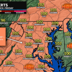
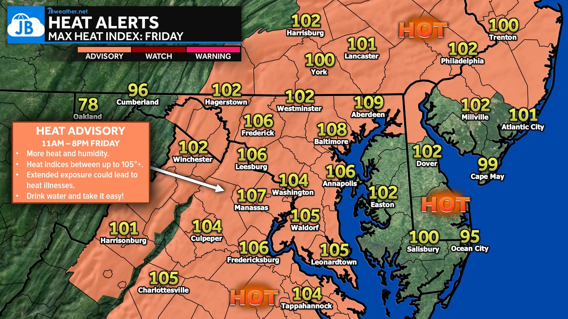
Temperatures are expected to climb into the lower and middle 90s this afternoon, with heat index values approaching 100-105 degrees in many locations. This combination of heat and humidity will create a very unstable atmosphere capable of supporting strong thunderstorm development.
Unlike Thursday’s setup, today’s forecast includes a more defined trigger for storm development. An approaching cold front, combined with a disturbance passing north of the region, should provide enough lift to help thunderstorms develop during the afternoon and evening hours. As a result, confidence is somewhat higher that storms will form somewhere across the region.
Primary Threats
💨 The primary concern will be damaging wind gusts. While storms may initially develop as individual cells, some could organize into clusters or short lines capable of producing wind gusts between 50 and 65 mph. These winds can easily bring down tree limbs, cause isolated power outages, and create hazardous travel conditions.
⛈️ Isolated large hail is also possible in the strongest storms, though the overall hail threat appears secondary to the wind threat. Frequent lightning and locally heavy rainfall can also be expected with any thunderstorm that develops.
📍 Forecast guidance suggests the greatest concentration of storms may develop along and south of the I-66 and US-50 corridors, though severe weather remains possible anywhere across the region. As is often the case with summertime severe weather events, not everyone will experience a storm. Some communities may remain completely dry while others deal with strong winds and heavy rain just a few miles away.
Remain weather aware this afternoon and evening and have multiple ways to receive warnings should severe thunderstorms develop.
Please note that this forecast is subject to subsequent changes and updates as we learn more information. Severe weather forecasting is far from a guarantee of anything. The goal of these forecasts is to alert you to the potential of storms, not a promise of storms.
Looking Ahead
The good news is that this active stretch of weather is nearing its end. A cold front is expected to move through the region tonight, ushering in noticeably lower humidity and somewhat cooler temperatures for the weekend. While temperatures will remain seasonably warm, the air should feel significantly more comfortable compared to the oppressive conditions experienced over the past several days
Stay with JB Weather for the latest information on impacts here in Southern Maryland and across the Mid-Atlantic. You can always access my forecasts and updates here on the website, on Facebook, on Twitter, on Instagram, and on YouTube. JB Weather is the Mid-Atlantic’s Weather Leader, and I am working around the clock to keep you ahead of any storm!
John Bordash
View More PostsJB Weather forecaster John Bordash is working around the clock to provide Southern Maryland, and neighboring communities, with accurate and reliable weather information.