After a beautiful day with sunshine and comfortable temperatures in the 70s, our attention turns to a weak area of low pressure expected to pass near the Mid-Atlantic overnight. While most locations will remain dry this evening, scattered thunderstorms may develop late tonight into early Wednesday morning, especially across areas southeast of Washington, D.C., including Southern Maryland and portions of the Delmarva.
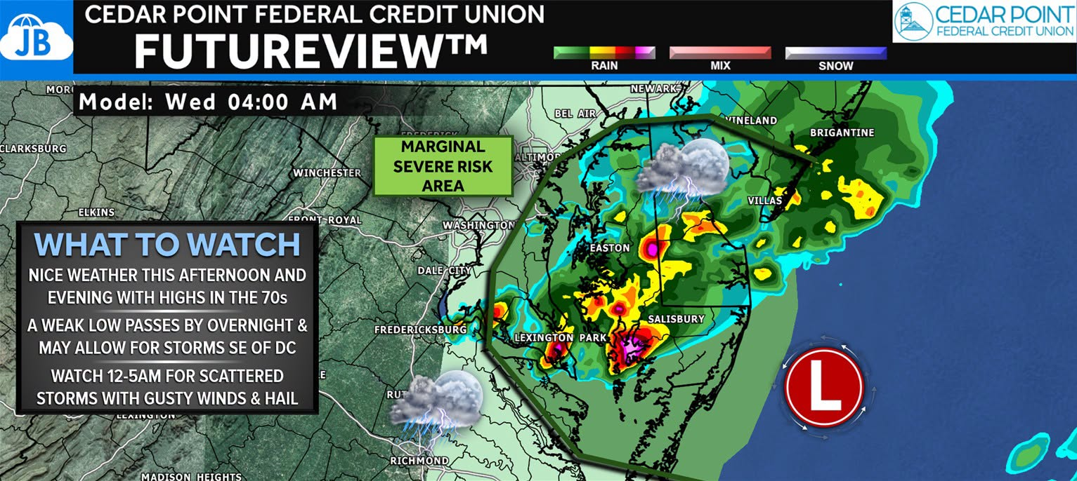
The overall severe weather threat remains low, but a few stronger storms could produce gusty winds and small hail between 12 AM and 5 AM. The strongest activity appears most likely near the Chesapeake Bay, Southern Maryland, and the Eastern Shore as the disturbance interacts with a northward-moving warm front. Most inland locations will likely see little to no impact, but if storms develop overhead, they could briefly become strong.
⚠️ What to Watch
• Enjoy the pleasant weather this afternoon and evening.
• Scattered storms may develop overnight, mainly 12 AM–5 AM.
• A few storms could produce gusty winds and hail.
• Greatest chance for impacts is across Southern Maryland and the Delmarva.
Stay with JB Weather for the latest information on impacts here in Southern Maryland and across the Mid-Atlantic. You can always access my forecasts and updates here on the website, on Facebook, on Twitter, on Instagram, and on YouTube. JB Weather is the Mid-Atlantic’s Weather Leader, and I am working around the clock to keep you ahead of any storm!
John Bordash
View More PostsJB Weather forecaster John Bordash is working around the clock to provide Southern Maryland, and neighboring communities, with accurate and reliable weather information.