We are off to a cloudy start to the day. Expect increasing breaks of sunshine through late morning and early afternoon. As temperatures climb into the lower-to-middle 90s and humidity increases, the atmosphere will become increasingly unstable ahead of an approaching storm system.
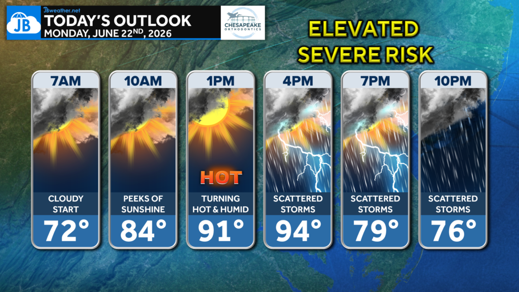
Scattered thunderstorms are expected to develop during the afternoon and continue into the evening. Some of these storms could become strong to severe, with damaging wind gusts being the primary concern. A brief tornado cannot be completely ruled out, and any stronger storm will be capable of producing torrential rainfall and localized flooding.
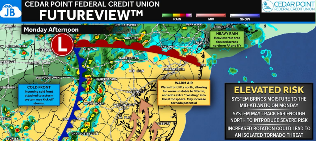
There is still some uncertainty regarding whether we see one primary round of storms this afternoon or if a second round develops later this evening. Regardless, it will be a day to stay weather-aware, especially from mid-afternoon through early evening.
Today’s Headlines:
🌤️ Increasing sunshine by late morning and early afternoon
🥵 Hot and humid with highs reaching the lower to middle 90s
⛈️ Scattered thunderstorms developing this afternoon
🌬️ Some storms may produce damaging winds
🌧️ Heavy downpours could lead to localized flooding
Stay with JB Weather for the latest information on impacts here in Southern Maryland and across the Mid-Atlantic. You can always access my forecasts and updates here on the website, on Facebook, on Twitter, on Instagram, and on YouTube. JB Weather is the Mid-Atlantic’s Weather Leader, and I am working around the clock to keep you ahead of any storm!
John Bordash
View More PostsJB Weather forecaster John Bordash is working around the clock to provide Southern Maryland, and neighboring communities, with accurate and reliable weather information.