After a cloudy and occasionally damp start to the day, conditions are beginning to evolve much as expected across the Mid-Atlantic. The warm front that I have been monitoring all weekend has now lifted into southern Pennsylvania, allowing much of Maryland, Delaware, and northern Virginia to enter a warm, humid air mass.
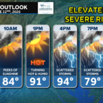
Temperatures have climbed into the mid and upper 80s across much of the region, with dewpoints approaching 70°. Combined with occasional breaks of sunshine, the atmosphere is becoming increasingly unstable ahead of an approaching cold front.
While there have been few meaningful changes to the forecast, confidence remains high that scattered strong to severe thunderstorms will develop later this afternoon and evening.
Current Setup
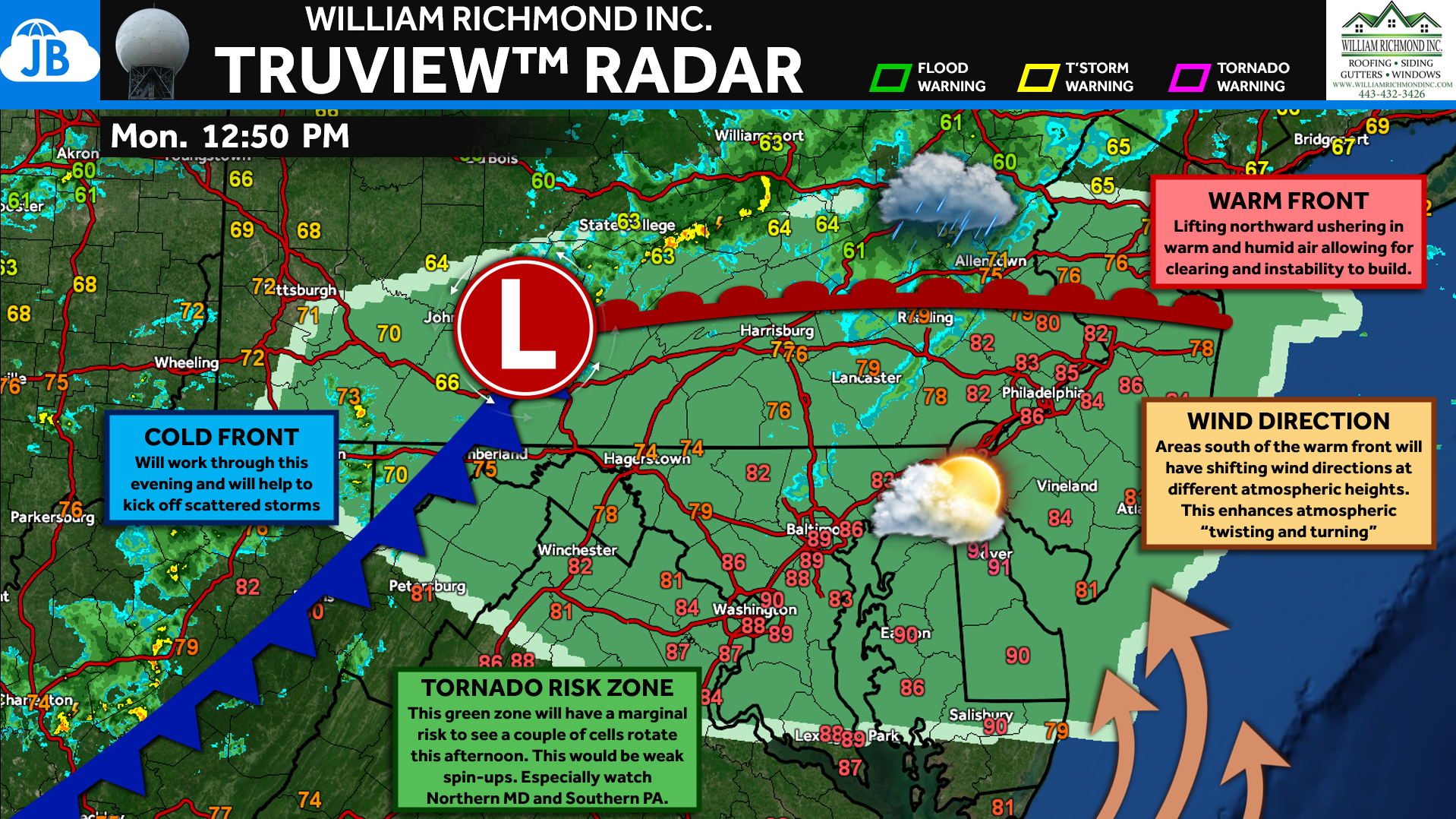
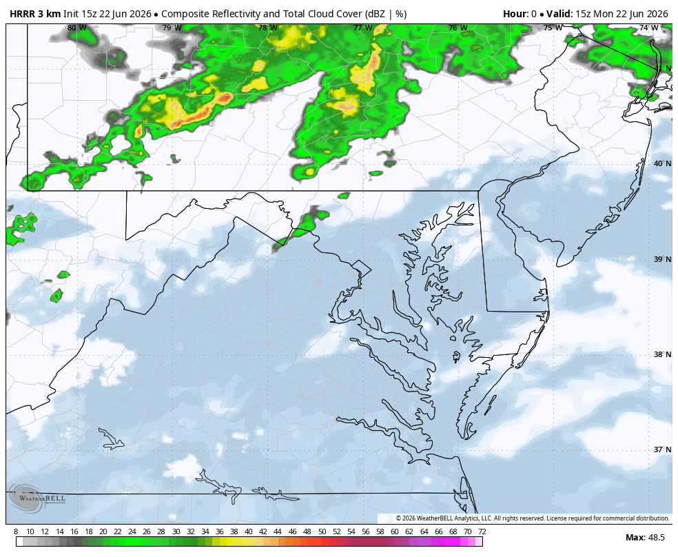
The radar analysis above shows the overall weather pattern unfolding as expected. The warm front has lifted into southern Pennsylvania while a cold front continues advancing eastward across the Ohio Valley.
South of the warm front, warmer temperatures and higher humidity are helping instability build across Maryland, Delaware, and surrounding areas. Meanwhile, the approaching cold front will provide the trigger needed for thunderstorms to develop later this afternoon.
One feature we’re watching closely is the changing wind direction with height near and south of the warm front. This creates additional atmospheric rotation, sometimes referred to as “spin,” which can help stronger storms organize.
Today’s Severe Weather Threat
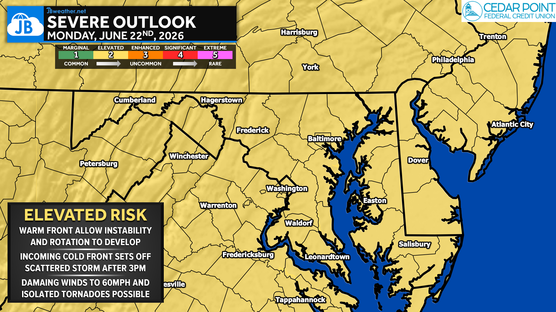
The Storm Prediction Center continues to place much of the region in a Level 2 of 5 (“Slight”) Severe Weather Risk, which JB Weather categorizes as an Elevated Risk day.
Storms are expected to begin developing during the mid-to-late afternoon hours as the cold front and pre-frontal trough move eastward. While not everyone will see severe weather, scattered storms could become strong enough to produce damaging wind gusts.
The primary concern remains:
🌬️ Damaging Winds up to 60 mph
Secondary concerns include:
🌪️ Brief Tornadoes
🌧️ Torrential Rainfall and Localized Flooding
The most favorable window for severe weather currently appears to be between 3 PM and 8 PM.
Understanding the Tornado Threat
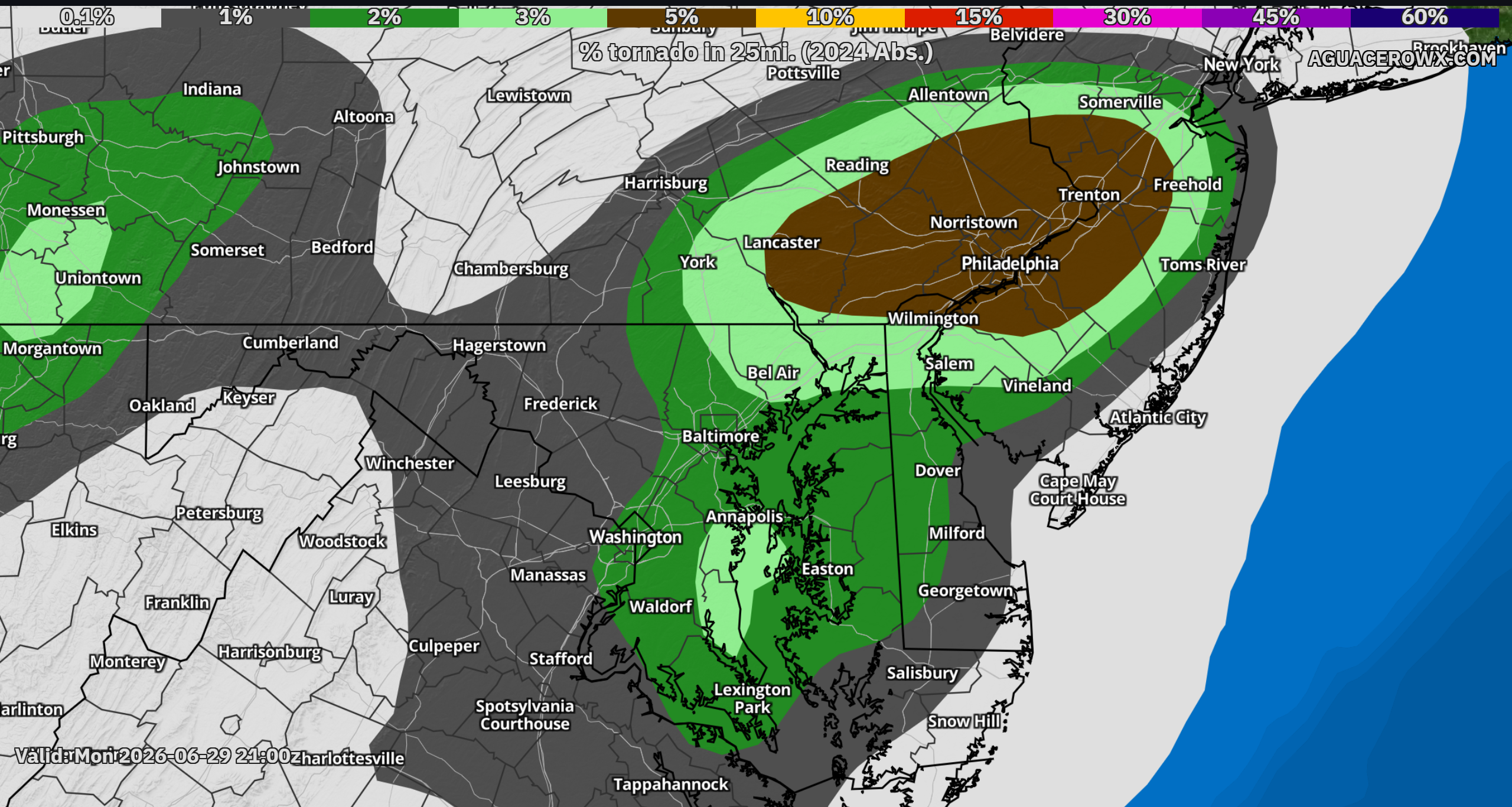
While damaging winds remain the primary concern today, an isolated tornado threat continues across portions of the Mid-Atlantic.
The graphic above comes from the Nadocast tornado guidance and highlights where atmospheric conditions may be most favorable for rotating storms. Notice the corridor extending from eastern Maryland and Delaware into southeastern Pennsylvania and New Jersey—very close to where the warm front is currently positioned.
This does not mean tornadoes are expected throughout the shaded area. Rather, it identifies where a few storms could briefly rotate if they can take advantage of the enhanced wind shear near the warm front.
At this time, the tornado threat remains low-end, but it is one aspect of today’s forecast that bears close watching.
Timing
- Early Afternoon (Now – 3 PM): Warm and humid conditions continue to build. Instability increases across the region. Isolated showers are possible.
- Mid-Afternoon Through Early Evening (3 PM – 8 PM): Highest severe weather threat. Scattered thunderstorms develop from west to east. Damaging winds become the primary concern.
- Evening (8 PM-Midnight): Some models suggest a secondary round of storms. Heavy rain remains possible. The Severe Threat gradually decreases overnight.
Bottom Line
The forecast remains on track this afternoon. The warm front has moved north, temperatures and humidity are rising, and the atmosphere is becoming increasingly favorable for thunderstorm development.
Most storms will simply bring heavy rain and lightning, but a few could become severe with damaging winds. An isolated tornado cannot be ruled out, particularly near the warm front where atmospheric rotation is greatest.
Quick Takeaways
⚠️ Severe weather threat remains on track this afternoon and evening.
🌡️ Temperatures have climbed into the 80s with increasing humidity.
⛈️ Storms are expected to develop after 3 PM and move west to east.
🌬️ Damaging winds remain the primary threat.
🌪️ A low-end tornado risk continues near the warm front.
🌧️ Heavy rainfall may cause localized flooding in stronger storms.
Stay with JB Weather for the latest information on impacts here in Southern Maryland and across the Mid-Atlantic. You can always access my forecasts and updates here on the website, on Facebook, on Twitter, on Instagram, and on YouTube. JB Weather is the Mid-Atlantic’s Weather Leader, and I am working around the clock to keep you ahead of any storm!
John Bordash
View More PostsJB Weather forecaster John Bordash is working around the clock to provide Southern Maryland, and neighboring communities, with accurate and reliable weather information.