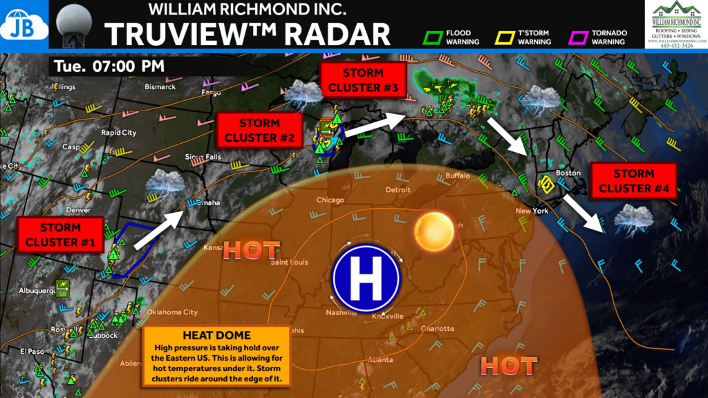
The weather pattern responsible for our upcoming dangerous heat wave is now firmly establishing itself across the eastern half of the country. At the center of it all is a massive area of high pressure, commonly called a “heat dome.” This dome acts like a lid on the atmosphere, trapping hot air near the ground while allowing temperatures to soar day after day.
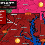
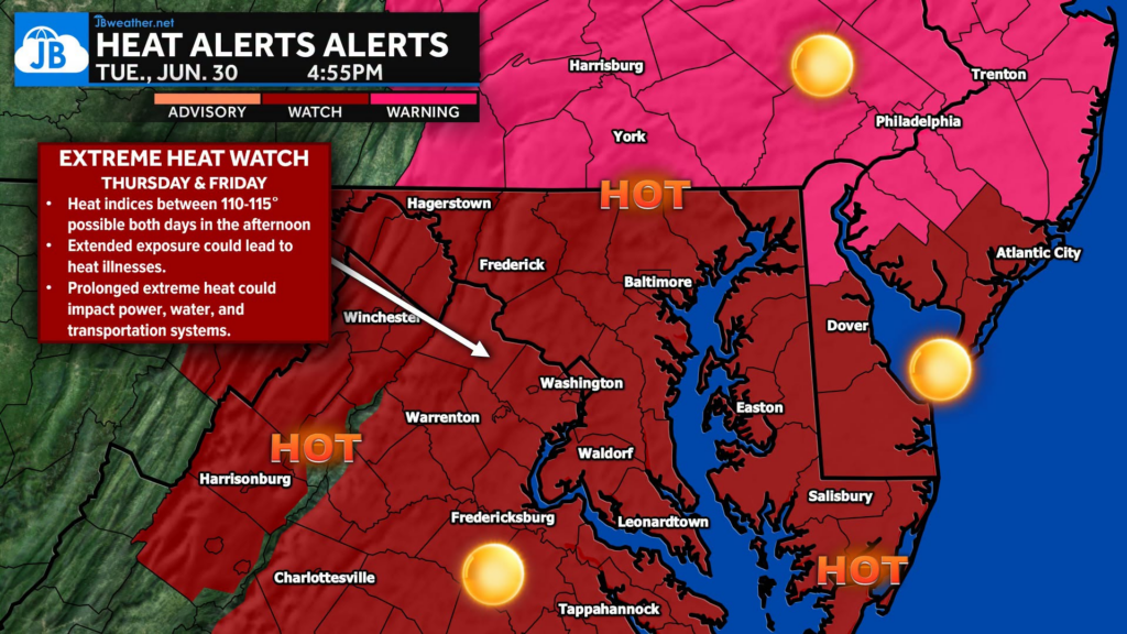
For us, we will see daily high temperatures climbing into the upper 90s and lower 100s into the weekend. This could become our most significant heat wave since 2012, with numerous daily record highs in jeopardy.
Storms are staying away from us…for now. The heat dome suppresses thunderstorm development underneath it, leading to long stretches of hot, sunny weather. Instead, storm systems are forced to ride around the outer edge of the ridge, much like water flowing around a rock in a stream. That’s why we’re seeing several clusters of severe thunderstorms tracking from the Plains through the Great Lakes and Northeast while the Mid-Atlantic remains largely dry. That won’t last forever…
As we head toward the Independence Day weekend, the ridge is expected to gradually weaken. As it does, disturbances will begin slipping around the edge of the heat dome and into the Mid-Atlantic. This is a pattern we often see after prolonged summer heat—the atmosphere stores tremendous amounts of energy, and once the ridge begins to break down, that energy can fuel powerful thunderstorms.
Stay with JB Weather for the latest information on impacts here in Southern Maryland and across the Mid-Atlantic. You can always access my forecasts and updates here on the website, on Facebook, on Twitter, on Instagram, and on YouTube. JB Weather is the Mid-Atlantic’s Weather Leader, and I am working around the clock to keep you ahead of any storm!
John Bordash
View More PostsJB Weather forecaster John Bordash is working around the clock to provide Southern Maryland, and neighboring communities, with accurate and reliable weather information.