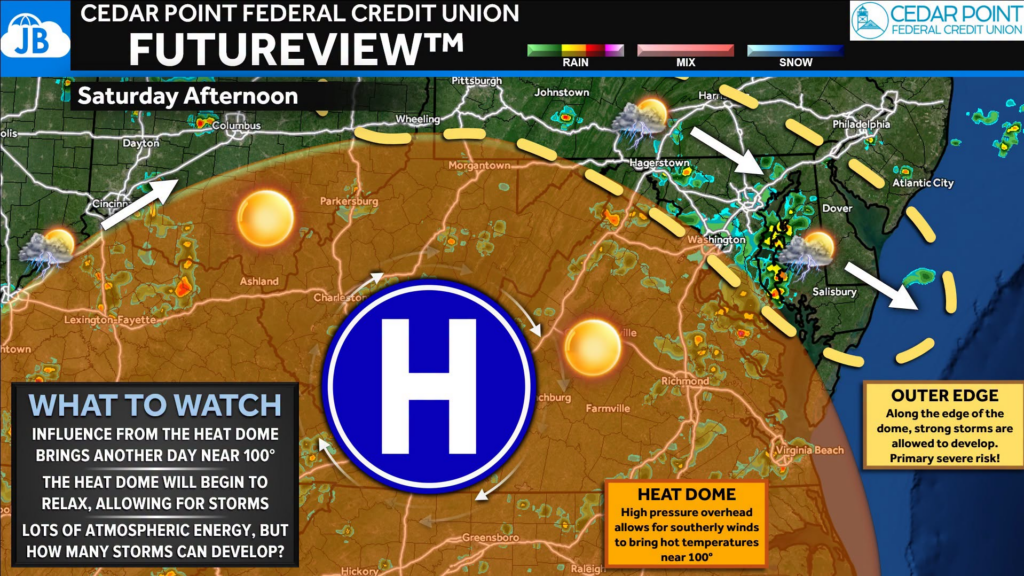
Saturday will feature another day of dangerous heat, but it also marks the beginning of a transition in our weather pattern. The heat dome that has brought record-breaking temperatures all week will begin to weaken, allowing isolated to scattered thunderstorms to develop during the afternoon and evening. The big question isn’t whether the atmosphere has enough energy—it certainly does. The question is how many storms can actually break through the remaining cap.
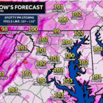
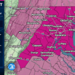
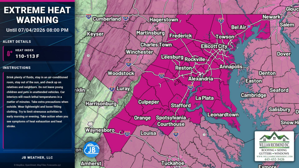
Forecast highs will once again climb near 100°, with heat index values reaching 105° to 110°. An Extreme Heat Warning remains in effect for much of the region.
As we move into the afternoon, thunderstorms may develop along bay and river breezes, the Blue Ridge, and other local boundaries. Any storm that forms will have plenty of fuel to work with, and could quickly become strong to severe.
Main threats with any storm:
• Damaging wind gusts
• Frequent lightning
• Torrential rainfall
• Localized flooding in poor drainage areas
Not everyone will see rain, but everyone should have a plan if you’re spending the holiday outdoors. Whether you’re at a cookout, the beach, or watching fireworks, keep an eye on the sky and have a way to receive weather warnings.
Bottom Line: Saturday won’t be a washout, but it won’t be completely dry either. Expect another day of dangerous heat, then watch for scattered afternoon and evening thunderstorms. Many locations may stay dry, while others could see a quick-hitting but potentially strong storm. If you have outdoor Fourth of July plans, be prepared for both the heat and changing weather conditions.
Stay with JB Weather for the latest information on impacts here in Southern Maryland and across the Mid-Atlantic. You can always access my forecasts and updates here on the website, on Facebook, on Twitter, on Instagram, and on YouTube. JB Weather is the Mid-Atlantic’s Weather Leader, and I am working around the clock to keep you ahead of any storm!
John Bordash
View More PostsJB Weather forecaster John Bordash is working around the clock to provide Southern Maryland, and neighboring communities, with accurate and reliable weather information.