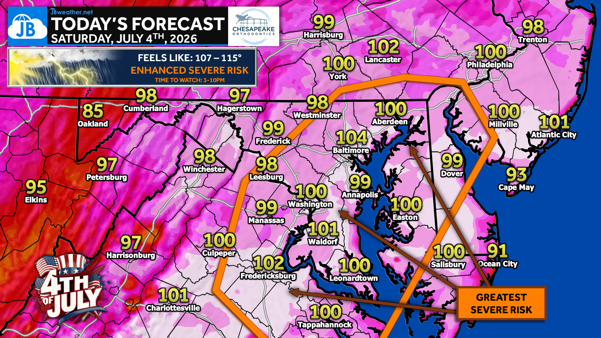
If you have outdoor plans today, you’ll want to keep an eye on the forecast. We’ll start the day with mostly sunny skies and another round of dangerous heat, with afternoon temperatures climbing to around 100°. Combined with tropical humidity, it will feel like 107° to 115°. An Extreme Heat Warning remains in effect for much of the region through this evening.
The weather story changes during the afternoon. The heat dome that has kept us mostly dry over the past several days is beginning to weaken, allowing thunderstorms to develop. At the same time, several days of intense heat and humidity have created an atmosphere loaded with energy. Once storms develop, they may strengthen quickly.
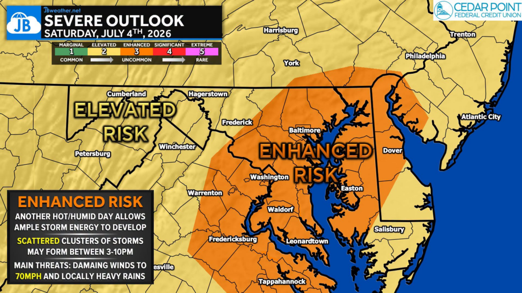
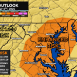
The greatest risk for severe weather appears to be from 3 PM to 10 PM, especially across areas along and east of I-95, where the Storm Prediction Center has placed much of the region in an Enhanced Risk (Level 3 of 5).
⛈️ The greatest threat looks to be between 3 PM and 10 PM, especially along and east of I-95, where the Storm Prediction Center has upgraded much of the region to an Enhanced Risk (Level 3 of 5).
⚠️ The main concern is damaging winds, with some storms capable of producing wind gusts of 60-75 mph. Frequent lightning, torrential rainfall, and isolated power outages are also possible.
One important thing to remember: this will not be an all-day rain event. Many hours will be dry, and some communities may not see a storm at all. However, any storm that does develop could become severe in a short amount of time.
🎆 If you’re heading to a parade, cookout, the beach, or fireworks tonight, have a backup plan and a way to receive weather warnings. Some fireworks displays could be delayed or interrupted depending on where storms develop this evening.
Stay with JB Weather for the latest information on impacts here in Southern Maryland and across the Mid-Atlantic. You can always access my forecasts and updates here on the website, on Facebook, on Twitter, on Instagram, and on YouTube. JB Weather is the Mid-Atlantic’s Weather Leader, and I am working around the clock to keep you ahead of any storm!
John Bordash
View More PostsJB Weather forecaster John Bordash is working around the clock to provide Southern Maryland, and neighboring communities, with accurate and reliable weather information.