Brought to you by Sonder Studios
Our region is set to see a winter storm bring moderate to high impacts Tuesday into Wednesday! With impactful snow likely to occur, the National Weather Service has issued widespread weather alerts.
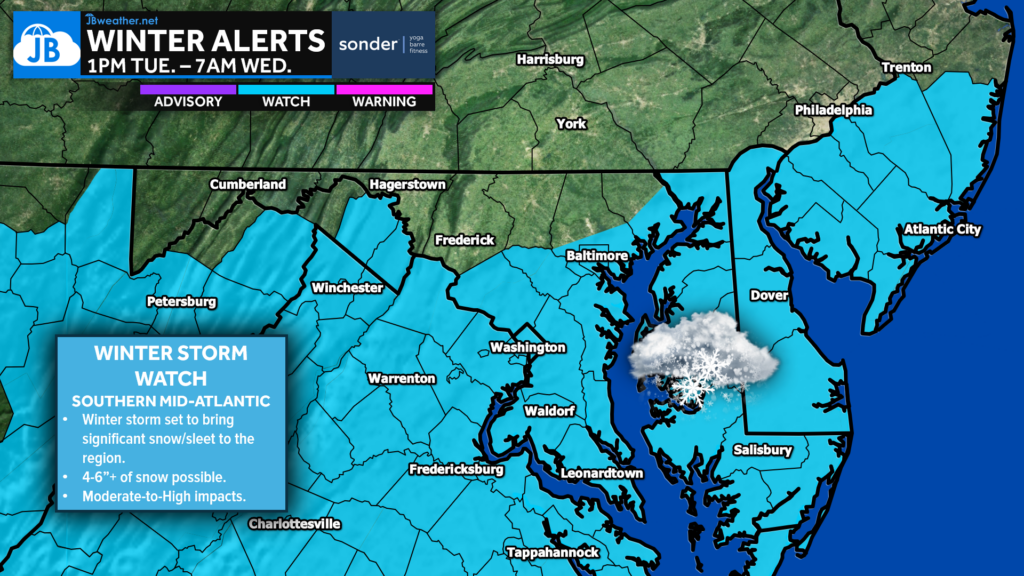
A Winter Storm Watch (shaded in blue) has been issued for much of the region from 10am Tuesday until 10am Wednesday. Accumulating snow is likely Tuesday, with impacts looking to linger into Wednesday morning. A look at Futureview is shown below.
This watch is for snow totals that may potentially near/exceed 5″. The watch also highlights the potential of some sleet and freezing rain for central Virginia counties.
Other National Weather Service offices have issued watches for the Delmarva peninsula, southern New Jersey, central Virginia, and much of West Virginia. No watches have been issued for southern Pennsylvania or northern Maryland yet as that region is set to be on the outer edge.
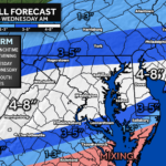
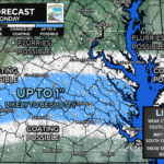
You can view my latest forecast, including my first call snow projection, the timing of the snow event, and potential impacts, by checking out the linked article below!
Stay with JB Weather for the latest information on impacts here in Southern Maryland and across the Mid-Atlantic. You can always access my forecasts and updates here on the website, on Facebook, on Twitter, on Instagram, and on YouTube. JB Weather is the Mid-Atlantic’s Weather Leader, and I am working around the clock to keep you ahead of any storm!

SONDER℠ Yoga studio. Barre studio. Fitness Studio. Classes, events & education for being well. Sonder is a mindful community, and you are invited. 5+ years in Calvert County, MD. We are grateful for your trust. Check out sonderstudios.us!
John Bordash
View More PostsJB Weather forecaster John Bordash is working around the clock to provide Southern Maryland, and neighboring communities, with accurate and reliable weather information.