Brought to you by R.E. Graves Heating & Air Conditioning
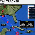
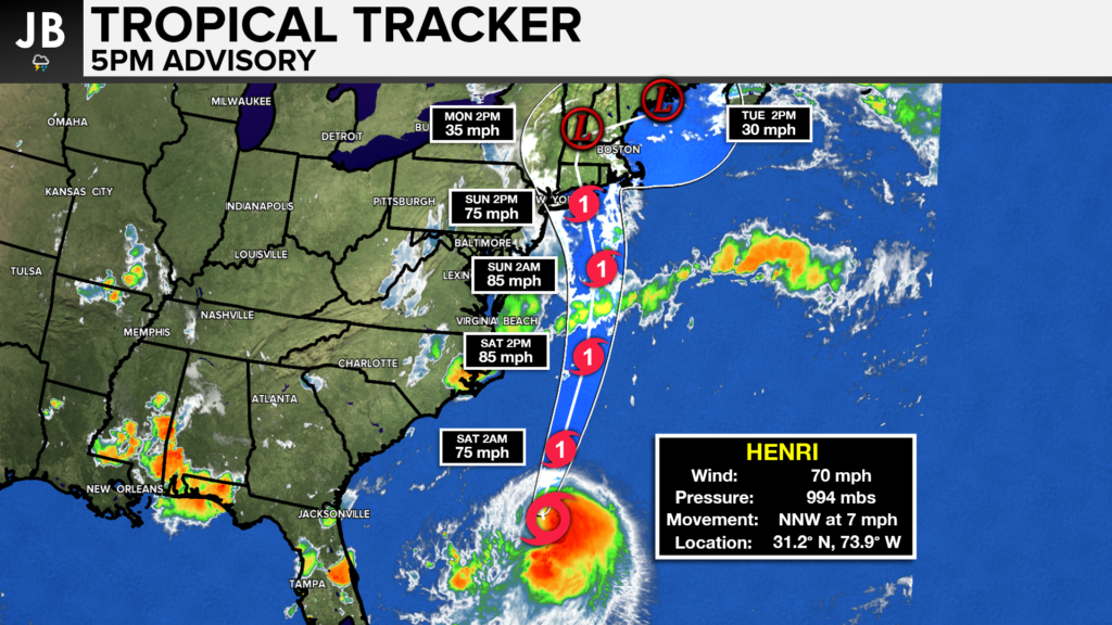
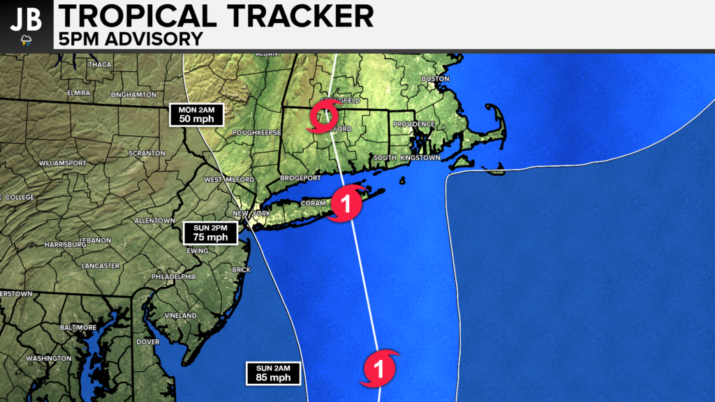
Today we have seen an increasing threat of high impacts across the Northeast as we continue to learn more about Henri (pronounced ahn-REE), and the storm’s future. It now appears very likely that the storm will turn northward and make landfall in either southern New England or on Long Island. There is some uncertainty with the exact location of landfall, and with how strong the storm will get. Today’s trends with our guidance have been pointing towards a more westward solution. This would mean a landfall from Henri on central, or eastern, Long Island; and potentially as a CAT 1 hurricane. Shown below is a wide view of Henri and his forecast track, along with a zoomed-in view on slide 2.
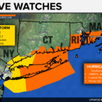
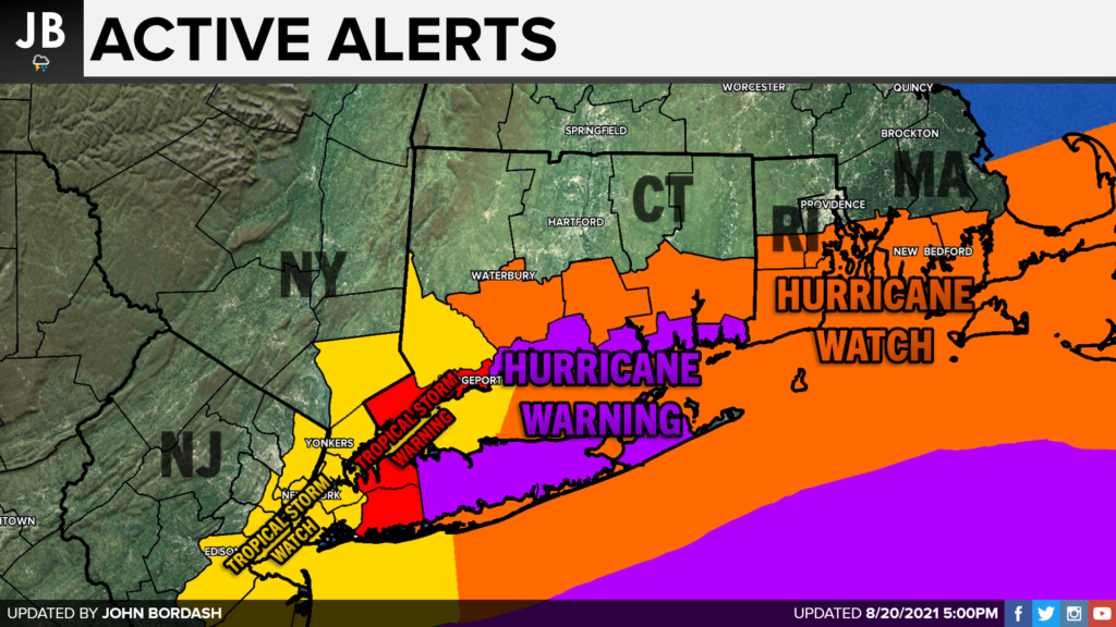
Parts of Long Island and coastal Connecticut are now under Hurricane Warnings, as it seems increasingly likely that this area will indeed see hurricane-force conditions. Watches remain elsewhere for greater uncertainty in the forecast. Tropical Storm Watches and Warnings are now up for the New York City tri-state area as the track continues to shift westward.
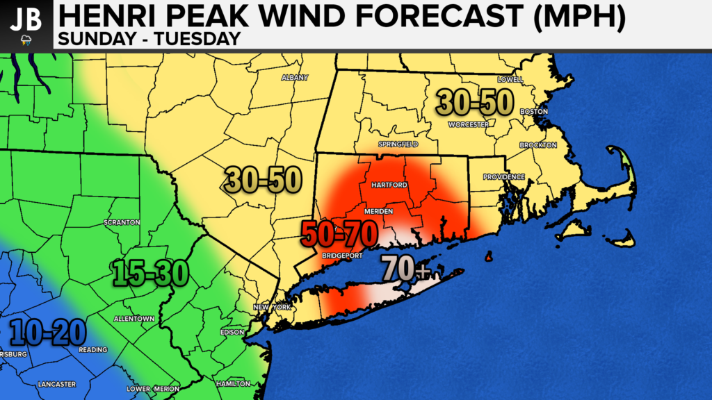
The highest winds are likely to be focused right along the front-facing coastal areas of southern Connecticut and Long Island. This is where peak winds of 50-70mph+ are possible. Tropical Storm force winds of 39mph+ appear likely across much of New England and the lower Hudson Valley. Winds should tapper off across New Jersey and Pennsylvania. With that said, and further shifts westward would much the highest winds further west.
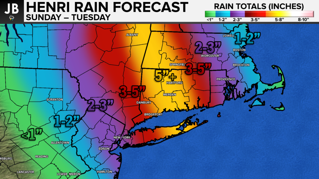
Heavy rain is also a threat. Some areas could see over 5″ of rain from Henri as the storm slows down on approach to the Northeast. Widespread amounts of 2-5″ are possible across the Northeast as the tropical moisture surges northward. The slowing down of the storm will lead to a lot of rain falling over an extended period. Like with the winds, and shift westward would push these rainfall numbers further westward as well.
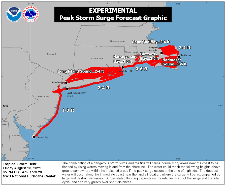
Storm surge will be an added threat with this storm. 50-70mph+ winds coming onshore, potentially during a high tide, will lead to widespread issues. The storm surge could get as high as 2-5 feet across southern New England and Long Island.
Henri is a dangerous storm that should be taken seriously. Those in the path of the storm should begin preparing for the first direct hit from a hurricane in New England in over 30 years. All interests should listen to local emergency management, and heed any calls of evacuation. This storm could pose an Extreme threat to this region as a landfall looks likely on Sunday, and impacts could linger as long as Tuesday.
It will be important to stay with JB Weather for the latest information on Henri and the potential impacts along across the Northeast. You can always access my forecasts and updates here on the website, on Facebook, on Twitter, and on YouTube. JB Weather is Southern Maryland’s Weather Leader, and I am working around the clock to keep you ahead of the storm!
-JB
R.E. Graves Heating & Air Conditioning is a ⭐️⭐️⭐️⭐️⭐️ HVAC Contractor serving St Mary’s & Calvert. Just mention JB Weather to Save 20% off your next Heating repair bill when you Book now! regraveshvac.net/jbweather20off
John Bordash
View More PostsJB Weather forecaster John Bordash is working around the clock to provide Southern Maryland, and neighboring communities, with accurate and reliable weather information.