After a quiet and comfortable Saturday, the atmosphere is rapidly becoming more favorable for severe thunderstorms across the Mid-Atlantic today as heat, humidity, and an approaching cold front combine to create a potentially active weather day.
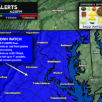
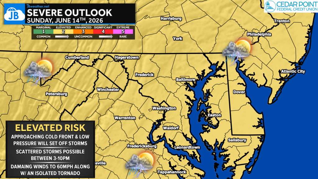
The Storm Prediction Center continues to place much of the region under a Level 2 of 5 “Elevated Risk” for severe thunderstorms, with damaging winds expected to be the primary hazard. While not everyone will experience a thunderstorm today, any storm that develops will have the potential to become severe.
Setup Favors Scattered but Intense Storms
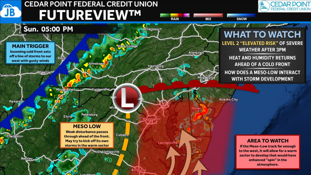
A strong upper-level disturbance moving through the Great Lakes will push a cold front toward the region later today. Ahead of that front, increasing southwesterly flow is transporting warmer and more humid air into the Mid-Atlantic.
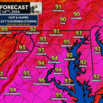
Temperatures are expected to climb into the lower and middle 90s this afternoon while dewpoints rise into the upper 60s and lower 70s. This combination will create a moderately to strongly unstable atmosphere capable of supporting vigorous thunderstorm development.
Unlike some severe weather events that feature a solid line of storms, today’s setup appears more favorable for thunderstorms developing along a pre-frontal trough near the Blue Ridge before organizing into clusters as they move eastward. This means storm coverage may initially be scattered, but storms that do form could become quite intense.
Primary Concern: Damaging Winds
The greatest threat today will be damaging straight-line winds. Latest data shows that there is ample storm energy across portions of the region. Combined with strengthening winds aloft, these ingredients will allow stronger storms to produce wind gusts of 60 to 70 mph. Localized tree damage, downed power lines, and scattered power outages will be possible where stronger storms occur.
Secondary Concern: Isolated Tornado Threats Remain Secondary
While damaging winds are expected to be the dominant hazard, we cannot completely rule out a few additional severe weather threats.
Wind shear may allow some storms to briefly organize into supercells. Should this occur, isolated hail and a brief tornado cannot be ruled out. However, the overall tornado threat remains relatively low due to limited low-level wind shear. Likewise, warm temperatures aloft should limit the hail threat, though an isolated severe hail report remains possible.
Timing
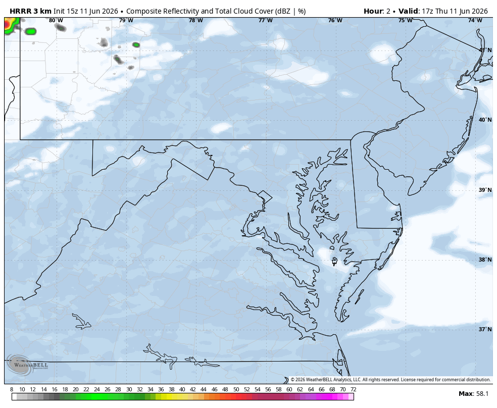
2 PM – 6 PM: Mountains and Blue Ridge- Storms are expected to begin developing during the mid-afternoon hours, particularly along and east of the Blue Ridge.
5 PM – 10 PM: I-95 Corridor and Chesapeake Bay Region- Storm coverage is expected to increase as thunderstorms move eastward into the Washington, Baltimore, Annapolis, Southern Maryland, and Delmarva regions. This period currently appears most favorable for severe weather.
10 PM – Midnight: Additional thunderstorms associated with the approaching cold front may move into western portions of the region after sunset. While weakening is expected, isolated strong storms could persist into the late evening hours.
What Makes Today’s Forecast Challenging?
One of the biggest forecast uncertainties involves storm coverage.
Most guidance suggests that thunderstorms will remain relatively scattered rather than forming a widespread squall line. As a result, some communities may receive little more than brief rain showers, while others experience severe wind damage from a single intense storm. Today’s threat is more about the potential intensity of individual storms rather than widespread coverage.
Key Takeaways
⚠️ Severe thunderstorms are expected to develop this afternoon and evening.
💨 Damaging wind gusts of 60-70 mph are the primary threat.
⛈️ Storms will likely be scattered, but any storm that develops could become severe.
🕔 Highest threat window for the DC, Baltimore, Southern Maryland, and Delmarva region is between 5 PM and 10 PM.
🌪️ A brief tornado or isolated hail report is possible, but both remain secondary threats.
Stay with JB Weather for the latest information on impacts here in Southern Maryland and across the Mid-Atlantic. You can always access my forecasts and updates here on the website, on Facebook, on Twitter, on Instagram, and on YouTube. JB Weather is the Mid-Atlantic’s Weather Leader, and I am working around the clock to keep you ahead of any storm!
John Bordash
View More PostsJB Weather forecaster John Bordash is working around the clock to provide Southern Maryland, and neighboring communities, with accurate and reliable weather information.