Brought to you by G and H Jewelers.
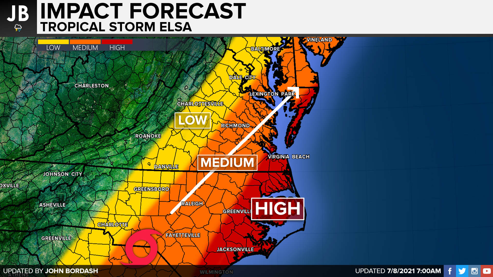
Tropical Storm Elsa continues to move inland, and up the East Coast, after making landfall yesterday in Florida. While The storm is on a weakening trend post-landfall, the storm will still bring sizable impacts to the coastal Mid-Atlantic. The highest impacts will be felt along the immediate ocean coastline, where the winds will be the worst. Heavy rain will spread inland though, bringing moderate impacts to our region.
Our Chesapeake’s Bounty Futurecast does a great job of timing out Elsa and showing her impacts on our region. Rain showers will look to kick off after lunchtime as moisture begins to surge northward. We will begin to see periods of heavy rain, with some embedded thunderstorms that may try to rotate, during the evening hours. Given the mass amount of twisting and turning in the atmosphere that comes with tropical storms, it will not be hard for a weak tornado or waterspout to try to spin up as the storm moves in. The worst of the weather will likely move in after sunset, as we approach midnight. Locally, we will see the heaviest rains and gustiest winds in southern Calvert and southern St. Mary’s Counties. We could see blinding rainfall in these regions. Elsa will continue to move up the coast, and we’ll see the rain begin to shut off between 2-4 AM. We will be clear by sunrise tomorrow morning.
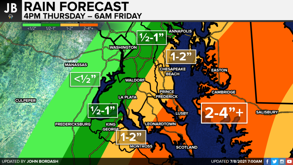

As mentioned before, the heaviest rain will fall in the southern portions of our region. 2-4″ of rain looks likely across southern Calvert and southern St. Mary’s County. This is where flooding problems have the highest likelihood of occurring. Rain totals will quickly trapper off to the northwest, with I-95 being on the edge of seeing half an inch of rain. A Flash Flood Watch is in effect for much of our region.
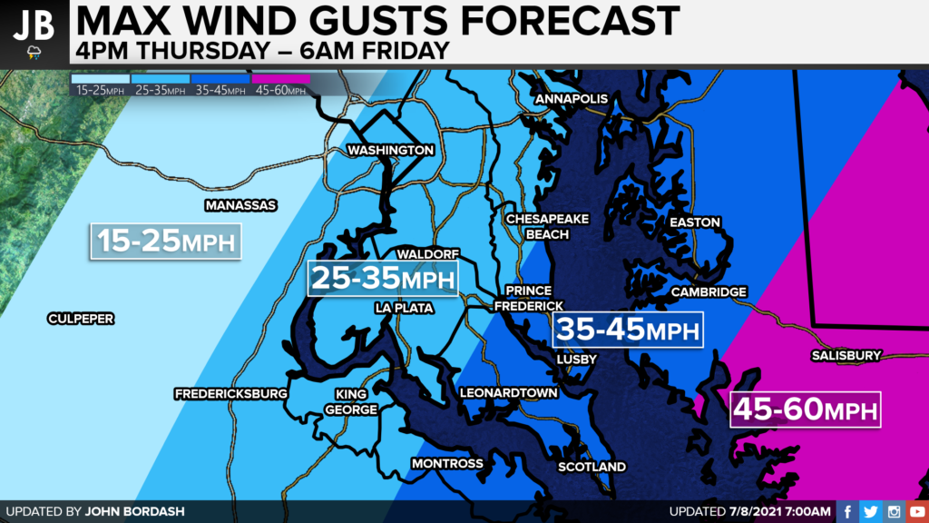
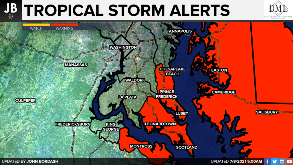
Like with the rain, the highest winds will occur the further east you head. 45-60mph wind gusts look likely across the lower eastern shore. 35-45mph wind gusts are possible across southern Calvert and southern St. Mary’s Counties. This is where we have a Tropical Storm Warning now in effect. We could see scattered outages here as well, especially for coastal areas.
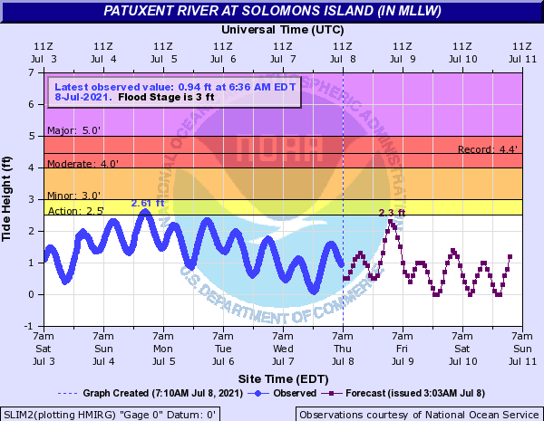
Even though we will see an onshore wind, we likely will not see major coastal flooding. Elsa’s wind field is weakening and has been on land now for about 24 hours. Coupling that with its quick forward motion will help to minimize our coastal flooding threat. The NWS forecast for our areas shows maybe an additional foot of water rise overnight, but not really to flood stage.
Summary
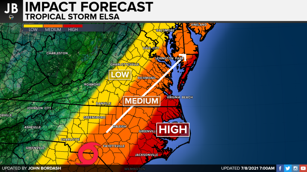
Elsa is on track to move through our region tonight.. Elsa does not look to be as bad as Isaias was last year. With that said though, we will see some moderate impacts, especially for our southern and eastern communities. I think we have the potential to see 2-4″ of rain in southern Calvert and southern St. Mary’s Counties. 35-45mph wind gusts may also lead to scattered power outages for coastal communities. I also cannot rule out a weak spin-up or two overnight. This forward motion will help to lower our risk for coastal induction. Elsa will be a quick mover, likely clearing the region before sunrise Friday.
It will be important to stay with JB Weather for the latest information on Elsa and her important impacts here in Southern Maryland. You can always access my forecasts and updates here on the website, on Facebook, on Twitter, and on YouTube. JB Weather is Southern Maryland’s Weather Leader, and I am working around the clock to keep you ahead of the storm!
-JB

Brought to you by G&H Jewelers. Shop G&H Jewelers Today for Loose Diamonds, Fine Diamond & Colored Gemstone Jewelry, On-site Custom Jewelry Design (CAD) & Manufacturing, Jewelry Repair and GIA Graduate Gemologist Appraisal Services. Third Generation Family Owned & Operated Since 1965.
