Brought to you by All in One Tag & Title
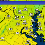
After a cold and snowy January, February has gotten off to quite the mild start! We are in the midst of a multi-day streak with temperatures in the 60s. However, this will not last long though. A cold front will move through Saturday, ushering in a fresh injection of cold air. This will set the stage for potential snow on Sunday.
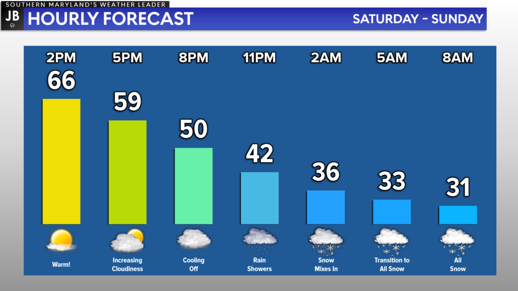
After hitting the 60s both Thursday and Friday, we will look to get into the middle 60s on Saturday. The warmth will come crashing down as the cold front moves through, bringing a dramatic drop in temperatures. We will likely see temperatures fall by 30° over the course of just 12 hours.
Shown above is the latest run of Futurecast, timing this system out. You can see that with the initial warmth, we may see rain showers breakout as we near midnight on Saturday. As temps fall early Sunday morning though, we will see any rain transition to snow. By Sunday morning, many areas should see light snow, especially southeast of DC. We will see the snow wrap quickly though, likely by lunchtime.
A system will develop along the frontal boundaries it pushes to our south. The quick forward motion of the system will limit our snow window to just a few hours on Sunday morning. The slower the system moves, the longer duration the snow will last. A longer duration storm would lead to higher accumulations, so the exact timing will need to be watched.
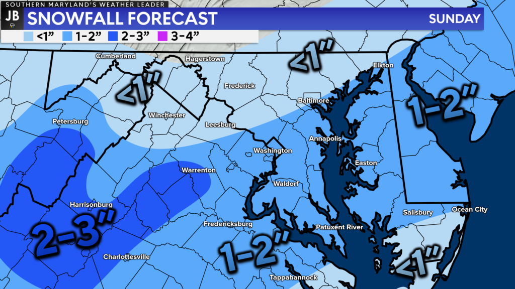
Right now, I do not think that this will be much more than an inch or two for much of our local area. The warm ground temperatures and short duration of the snow will limit accumulation. Most accumulation will likely be on the grassy areas, with little on paved surfaces.
The highest totals will be in the central Shenandoah Valley, where the more moderate snow will fall. Lower totals will be both to our north, thanks to limited precipitation, and to our south, due to a later arrival of cold air. Our region sits in between those two zones, in a “sweet spot.”
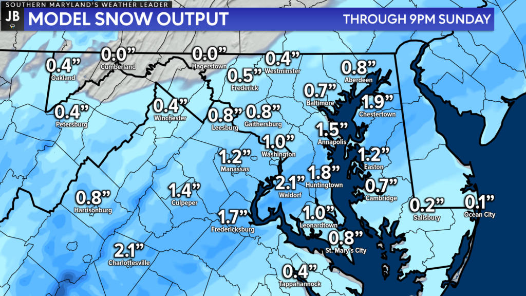
Much of our model guidance is in agreement with my forecast, only showing an inch or two. You can see how there will be a stripe of locally higher totals, which will likely come through our region. We’ll have to see how wide the stripe can be, and if it moves further north or south.
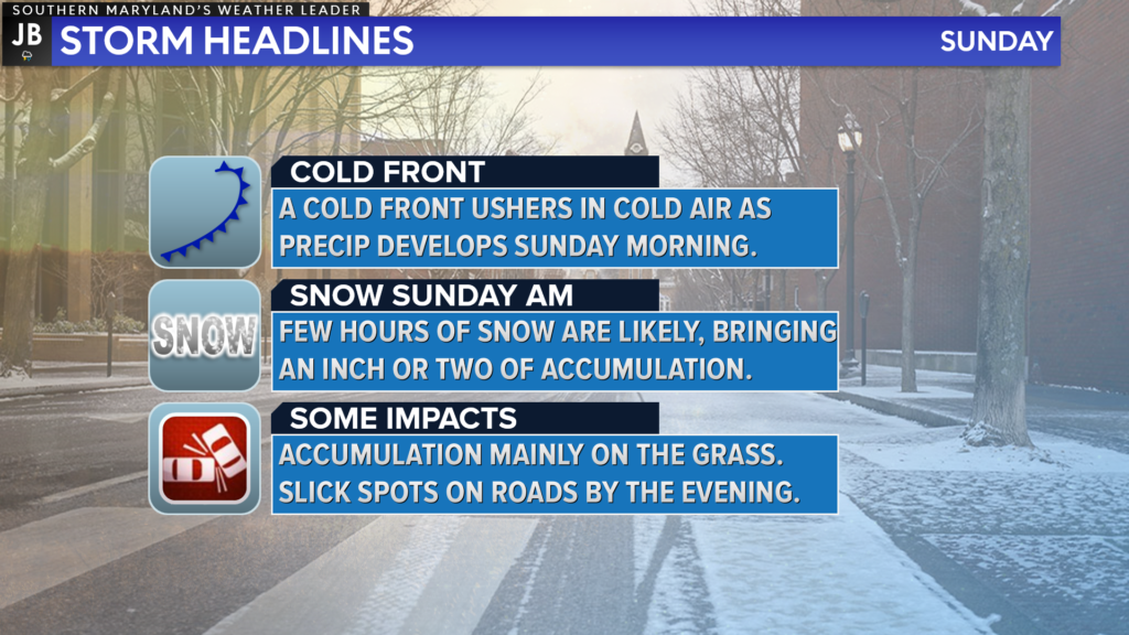
All in all, this does not look to be a big event. We are talking only about minor totals of an inch or two, with limited accumulation on roadways. Much of the snow should be out of here in time for Super Bowl viewing parties. Do be aware that we could see slick spots develop by the evening, thanks to cooling temperatures.
It will be important to stay with JB Weather for the latest information on this interesting forecast and its impacts here in Southern Maryland. You can always access my forecasts and updates here on the website, on Facebook, on Twitter, and on YouTube. JB Weather is Southern Maryland’s Weather Leader, and I am working around the clock to keep you ahead of the storm!
-JB

At All In One Tag & Title, we make quick work of MVA Tag & Title Services! We are located in Owings, MD on the corner of Chaneyville Rd. Give us a call at 301-327-5081 or stop by, no appointment needed! Mention you saw us on JB Weather and get $5.00 off tag & title services. Check out www.allinonellc.net today!
