Brought to you by G&H Jewelers, Inc.
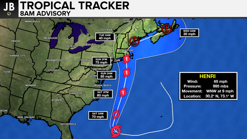
Overnight data and model guidance have continued to show Tropical Storm Henri (pronounced ahn-REE) taking a track over New England this weekend. Given the consistency with this, the timeframe closing in, Hurricane Watches have been issued for much of coastal Southern New England, and Long Island. This is where hurricane conditions look possible over the next 48 hours. Tropical Storm Watches have been issued further westward for winds potentially up to 39mph. Aside from rough surf, this should not impact the Mid-Atlantic.
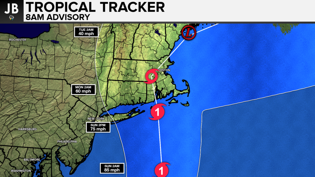
Tropical Storm Henri has been looping around Bermuda this week and will look to turn northward today. The storm will be strengthening as it does so with favorable atmospheric conditions. The storm will not be a fast-mover like many New England storms are. This storm will likely close in on the Southern New England coastline by Sunday, and linger across that area for 36-48 hours before getting pushed out to sea. The models do still disagree with how far west this storm comes. The cone of uncertainty currently includes areas from New York City to Cape Cod for a potential landfall, which is critical to remember. Henri could come on onshore anywhere in this cone. Shown below is the forecasted track of Henri. Slide 1 is a wide shot of the forecast with the second slide featuring a zoomed-in look at New England.
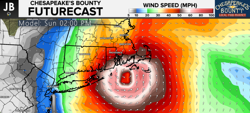
Our Chesapeake’s Bounty Futurecast model is among the many showing a landfalling hurricane in New England on Sunday. You can see how the storm slowly approaches from the south before making landfall Sunday afternoon. Heavy rain will be likely across much of this region. Some areas could see as much as 3-7″+.
Our Futurecast model also depicts the high winds spreading across the region as Henri approaches. Winds between 50-80mph could be possible across Southeastern Massachusetts, Road Island, Eastern Connecticut, and Eastern Long Island. A larger area of 30-50mph will be possible across much of the Northeast. These winds should gradually diminish as the storm weakens over land, but it will take some time for that to happen.
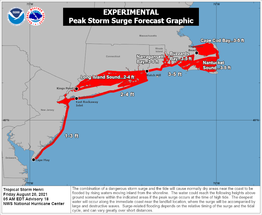
With the strong onshore flow, storm surge is a concern across this region. Shown below is the National Hurricane Center storm surge forecast as of 8AM. The storm surge could get as high as 3-5 feet in some locations. This will likely devastate coastal communities, especially at times of high tide.
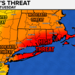
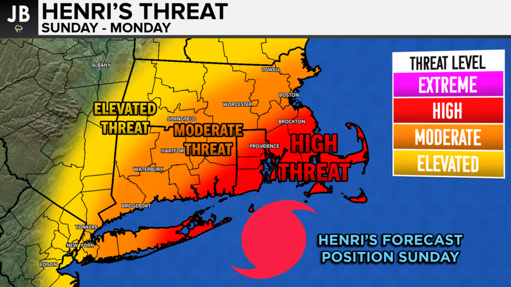
A high threat from the approaching hurricane exists across parts of Southern New England. The area that is likely to feel the highest impacts will be areas in the right front quadrant of the storm. This could potentially include all of Southeastern Massachusetts, Road Island, Eastern Connecticut, and Eastern Long Island. This is where the heavy rain, damaging winds, and storm surge are likely to be the worst. This could be the worst storm to hit New England directly in about 30 years. All interests in this region should stay tuned to forecasts and information from local emergency officials. Residents should begin preparing for a powerful storm to make landfall on Sunday with long-lasting impacts.
It will be important to stay with JB Weather for the latest information on Henri and the potential impacts along across the Northeast.. You can always access my forecasts and updates here on the website, on Facebook, on Twitter, and on YouTube. JB Weather is Southern Maryland’s Weather Leader, and I am working around the clock to keep you ahead of the storm!
-JB
Shop G&H Jewelers Today for Loose Diamonds, Fine Diamond & Colored Gemstone Jewelry, On-site Custom Jewelry Design (CAD) & Manufacturing, Jewelry Repair and GIA Graduate Gemologist Appraisal Services. Third Generation Family Owned & Operated Since 1965.
John Bordash
View More PostsJB Weather forecaster John Bordash is working around the clock to provide Southern Maryland, and neighboring communities, with accurate and reliable weather information.