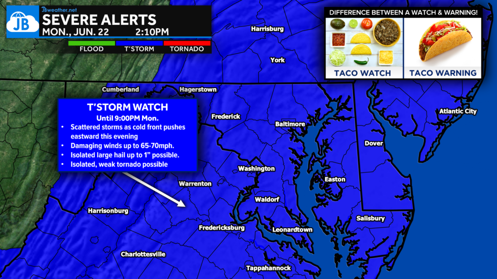
The Storm Prediction Center has issued a Severe Thunderstorm Watch for much of Maryland, Delaware, Washington D.C., northern and central Virginia, southeastern Pennsylvania, southern New Jersey, eastern West Virginia, and adjacent coastal waters through 9:00 PM EDT. The watch was issued as a warm, humid air mass remains in place ahead of an approaching cold front that is expected to trigger scattered thunderstorms across the region this afternoon and evening. While not everyone will experience severe weather, conditions are favorable for thunderstorms capable of producing damaging winds, large hail, torrential rainfall, and even an isolated tornado.
What Is Driving Today’s Threat?
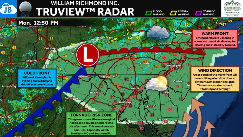
Today’s severe weather threat is being driven by a combination of heat, humidity, and an approaching cold front.
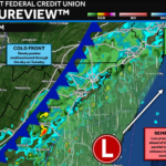
Throughout the day, a warm front has lifted northward into Pennsylvania, allowing much of the Mid-Atlantic to enter a warm and increasingly unstable air mass. Temperatures have climbed into the 80s and lower 90s while dewpoints near 70 degrees have provided plenty of moisture for thunderstorm development.
Meanwhile, a cold front advancing eastward from the Appalachians will act as the trigger for storm formation this afternoon. Winds also increase significantly with height, creating an environment favorable for organized thunderstorms. According to the Storm Prediction Center, storms are expected to develop and spread eastward through the afternoon before moving offshore after sunset.
Main Threats
🌬️ Damaging Winds: The primary concern today will be damaging straight-line winds. The Storm Prediction Center indicates that some storms could produce wind gusts of 65 to 70 mph, capable of downing trees, causing scattered power outages, and producing localized damage.
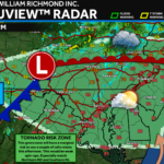
🌪️ Isolated Tornadoes: While not the primary threat, the watch includes the possibility of a tornado or two. Areas near the warm front and any stronger rotating storm will need to be monitored closely.
🧊 Large Hail: Some of the strongest storms may also be capable of producing hail up to 1 inch in diameter.
🌧️ Heavy Rainfall: Any thunderstorm will be capable of producing torrential downpours. Localized flooding may occur where storms repeatedly move over the same area.
Timing
2 PM – 5 PM
- Storms begin developing and increasing in coverage across western portions of the watch area.
- Initial stronger cells may quickly become severe.
4 PM – 8 PM
- Highest severe weather threat.
- Thunderstorms spread west to east across Maryland, Virginia, Delaware, D.C., and southern Pennsylvania.
- Greatest risk for damaging winds and isolated tornadoes.
8 PM – 10 PM
- Storms gradually push toward the coast.
- Severe threat slowly diminishes from west to east.
After 10 PM
- Most storms weaken or move offshore.
- Conditions improve overnight.
Watch vs. Warning
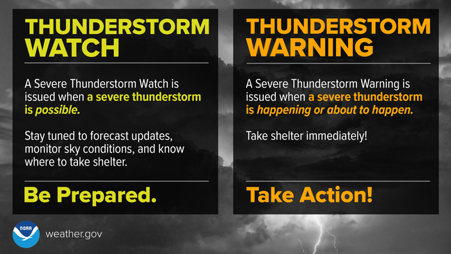
A Severe Thunderstorm Watch means conditions are favorable for severe thunderstorms to develop. A Severe Thunderstorm Warning means a severe thunderstorm is happening or is about to happen, and action should be taken immediately. Remember:
🌮 Taco Watch = The ingredients are on the counter.
🌮 Taco Warning = The taco is ready to eat.
Bottom Line
A Severe Thunderstorm Watch is now in effect until 9 PM as conditions become favorable for scattered severe thunderstorms across the Mid-Atlantic. The primary threat will be damaging winds up to 70 mph, but isolated hail and a tornado or two remain possible.
The most active period appears likely to occur between late afternoon and early evening, when storms will be moving west to east across the region. Everyone within the watch area should remain weather-aware, have multiple ways to receive warnings, and be prepared to take action if a Severe Thunderstorm Warning or Tornado Warning is issued later today.
Quick Takeaways
⚠️ Severe Thunderstorm Watch in effect until 9 PM.
🌬️ Damaging winds up to 70 mph are the primary threat.
🌪️ A tornado or two cannot be ruled out.
🧊 Isolated hail up to 1″ possible.
🌧️ Heavy rainfall may cause localized flooding.
📱 Have multiple ways to receive warnings this afternoon and evening.
Stay with JB Weather for the latest information on impacts here in Southern Maryland and across the Mid-Atlantic. You can always access my forecasts and updates here on the website, on Facebook, on Twitter, on Instagram, and on YouTube. JB Weather is the Mid-Atlantic’s Weather Leader, and I am working around the clock to keep you ahead of any storm!
John Bordash
View More PostsJB Weather forecaster John Bordash is working around the clock to provide Southern Maryland, and neighboring communities, with accurate and reliable weather information.