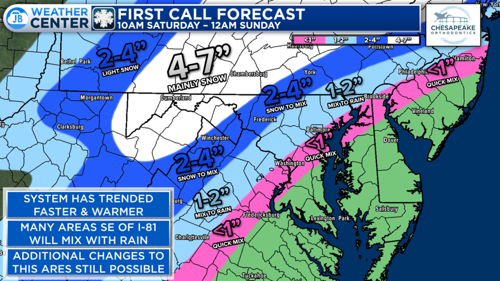
Now that I am home from a full day of teaching… The stage is set for tomorrow’s mess of a storm! Precip looks to move in between 9a-12p from southwest VA to PA. Our latest Cedar Point Federal Credit Union Futurecast run continues to show all cold rain (up to 1″) along/SE of I-95. Snow goes to rain between I-95 & I-81, w/ a couple of inches of snow possible. Several inches of snow NW of there.
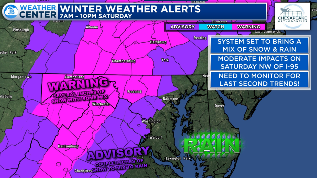
Winter Storm Warnings are up in the pink zone, where several inches of snow (3-6″+) will bring moderate impacts. Advisory in purple where the snow goes to mix & rain.
Up to an inch of cold rain is possible along and southeast of I-95. The weather situation across the Mid-Atlantic will be crappy at best tomorrow. But I still hold on to my first call forecast from yesterday- no reason to change it! Consistency & lack of hype are key and are the core of JB Weather. This storm is yet another example of why!
Game set match for tomorrow! I’ll have updates and coverage throughout the day.
Stay with JB Weather for the latest information on impacts here in Southern Maryland. You can always access my forecasts and updates here on the website, on Facebook, on Twitter, and on YouTube. JB Weather is Southern Maryland’s Weather Leader, and I am working around the clock to keep you ahead of any storm!
-JB
John Bordash
View More PostsJB Weather forecaster John Bordash is working around the clock to provide Southern Maryland, and neighboring communities, with accurate and reliable weather information.