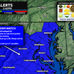
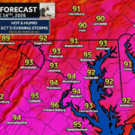
After a quiet and comfortable Saturday, the atmosphere will quickly become more favorable for severe thunderstorms on Sunday. A cold front approaching from the west will interact with a return of heat, humidity, and strong winds aloft, creating an environment capable of producing scattered severe thunderstorms after 2-3 PM and continuing into the evening hours.
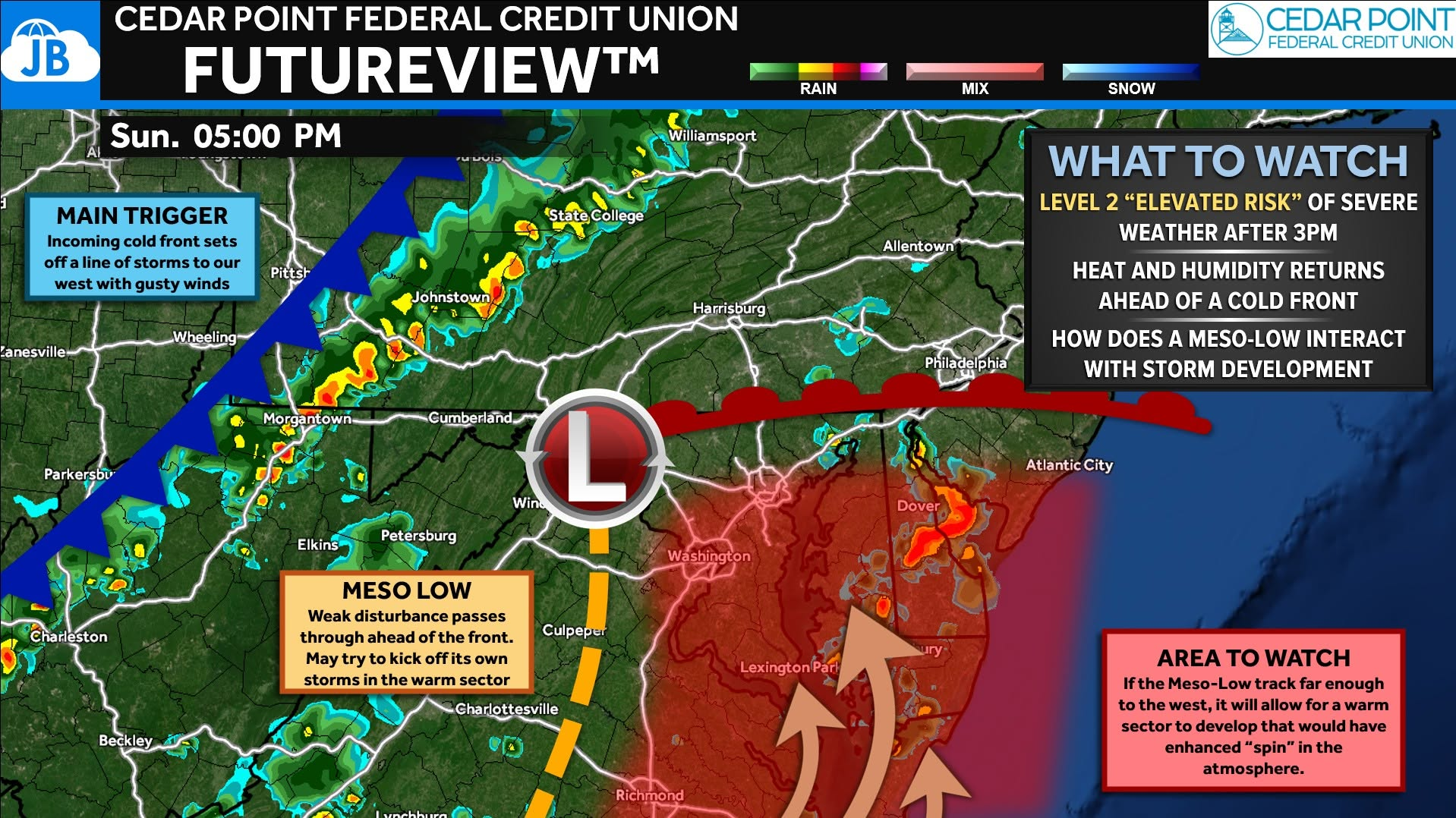
The primary threat will be damaging wind gusts of 60-70 mph, which could bring down trees and power lines. While damaging winds are the main concern, a few storms may become supercellular and could also produce isolated hail and a brief tornado. The Storm Prediction Center has placed the region in a Level 2 of 5 “Elevated Risk”, with some indications that portions of the Mid-Atlantic are nearing Enhanced Risk criteria if storm coverage and organization become more widespread. Even still, this does not appear to be a widespread severe weather outbreak.
One of the biggest forecast questions involves a weak area of low pressure (meso-low) developing ahead of the front. If it tracks far enough west, it could allow a warmer, more unstable air mass to surge northward and enhance storm intensity across parts of the region. Regardless of the exact details, Sunday afternoon and evening will be a period to closely monitor weather conditions and have multiple ways to receive warnings.
📌 Key Takeaways Summary
🌩️ Severe thunderstorms are possible Sunday afternoon and evening, especially after 3 PM.
💨 Damaging wind gusts of 60-70 mph are the primary threat and could cause scattered tree and power line damage.
⚠️ An isolated tornado and pockets of hail cannot be ruled out, particularly with any stronger storms that remain discrete.
🌤️ Much cooler, drier, and less humid weather arrives Monday behind the cold front.
John Bordash
View More PostsJB Weather forecaster John Bordash is working around the clock to provide Southern Maryland, and neighboring communities, with accurate and reliable weather information.