Brought to you by Chesapeake’s Bounty
Hurricane Season got off to a historically slow start after many forecasts called for an active season. Well, we are finally seeing tropical activity tick up. Hurricane Fiona made landfall in the Canadian Maritimes last night, bringing CAT 2 hurricane winds to the region. And now, we have Tropical Storm Ian in the Caribbean that may bring impacts to the US.
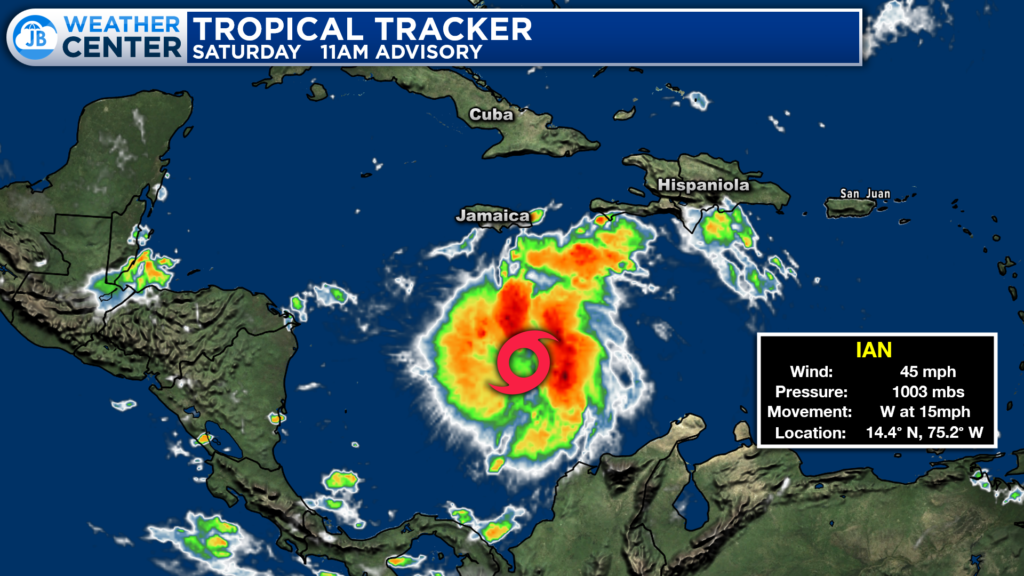
The 11AM Advisory on Tropical Storm Ian shows the storm moving westward through the Caribbean Sea, south of Hispaniola (where Haiti and the DR are). Ian is not overly strong at the moment, with winds of just 45mph. This is because Ian is battling some subpar atmospheric conditions at the moment. However, those should decrease later on this weekend. Then, we start to see potential problems…
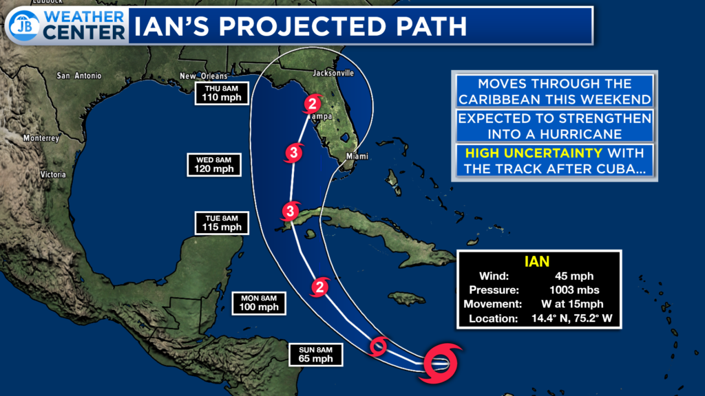
Ian will begin to turn northward tomorrow. As it does so, we will start to see the storm strengthen. By early next week, we will see Ian scrape by the Cayman Islands where Hurricane Watches are in effect. The current National Hurricane Center forecast brings Ian northward across the tip of Cuba and then into the Gulf.
The cone of uncertainty brings Ian potentially into the Florida coastline by the middle parts of next week as a strong CAT 2 or CAT 3 Major Hurricane. Verbatim, this potential track is very reminiscent of Charley from 2004. However, there is a high degree of uncertainty that comes into play with this forecast as Ian approaches Cuba and potentially moves into the Gulf.
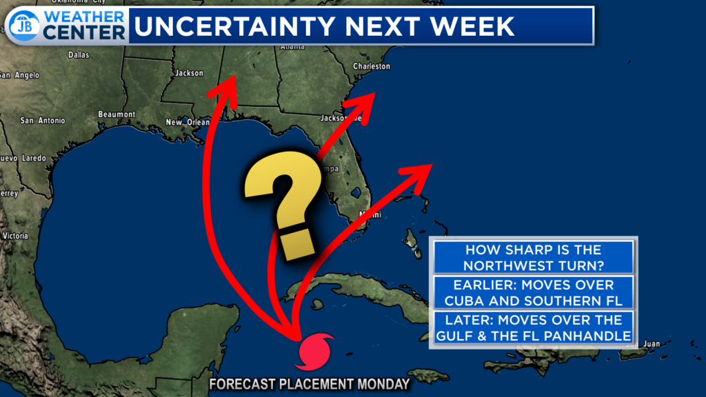
The biggest questions at play right now are: How sharp is the northward turn that Ian will make, and how quickly will Ian be moving? If Ian is moving quicker, the storm will take a sharper northeast turn, and impact Cuba and southern Florida. However, if Ian is slower, it will not take a sharp northeast turn, and would then slide into the Gulf and potentially impact the Florida panhandle.
Right now, our American Model favors a western track while the European Model favors an eastern track, but has been shifting towards the American Model. Both potential tracks would mean very different impacts on the people of Florida.
We have seen our models flip flop a lot this week on how this may play out, and most of our models are still not in total agreement on what will happen. Right now, the National Hurricane Center forecast cuts the difference and takes Ian into the central Flordia coastline, which is also possible.
What this all means is that this forecast is subject to a lot of change over the coming days. We cannot lock into any one potential outcome just yet, which is frustrating for people who would like to prepare.
How could this impact Southern MD? Well, if Ian were to turn northeast earlier, and move across the southern tip of Florida, we could then see the storm try to slide up the East Coast. While this scenario is not the most likely, it is possible. I say this not to alarm anyone or hype this up, but to make you aware. I personally do not think that we will see that happen, and I tend to think that Ian will take a more western track, and impact the Florida panhandle. But again, we cannot lock into that and need to see how things will play out.
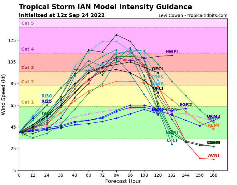
What is not as uncertain is the intensity forecast of Ian. Shown above is a graph that displays how our different models are forecasting Ian’s intensity throughout time. The Y-axis features wind speed strength, and the X-axis represents time. The further right you head, the deeper into time you get. Each line represents a different model.
Most of our models do agree that Ian is likely to rapidly intensify over the next 60-84 hours. We could see Ian strengthen into a hurricane as early as 36 hours from now, and potentially reach CAT 3 Major Hurricane status in just 60-72 hours.
The Gulf waters are warm, and how strong Ian gets will be determined by how much time he spends over them. A slower system that does turn as sharply to the northeast will be able to become much stronger than a quick-moving system that turns northeast sooner.
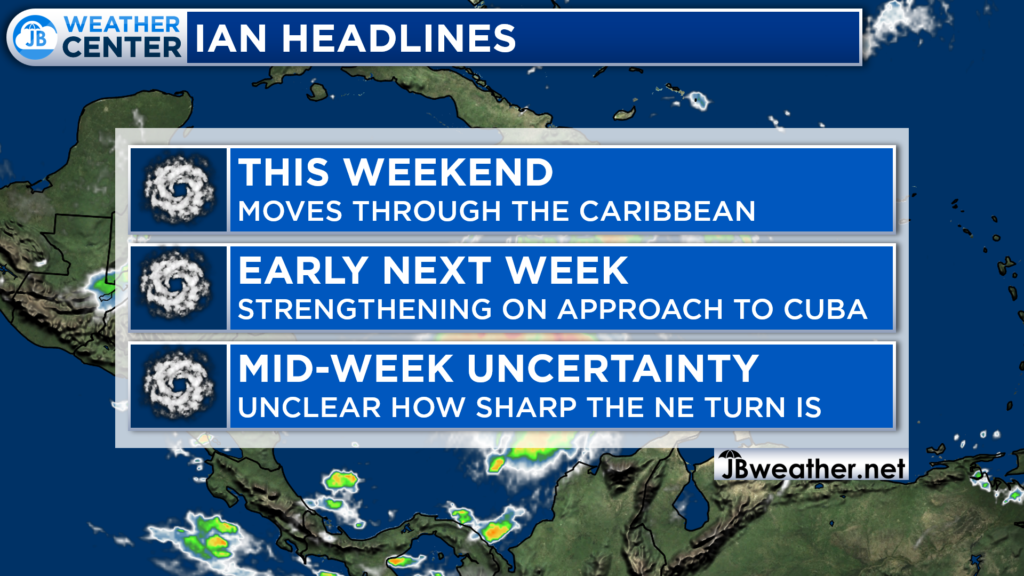
All in all, this forecast is quite complicated. Ian is likely to strengthen over the next 3-4 days as the storm tracks northwestward through the Carribran and towards Cuba. There is a lot of uncertainty about how the forecast may play out after there because we are unsure how sharply Ian will turn northwestward and how fast Ian will move. With that said, all interests in Florida need to keep tabs on this storm. Everyone in the southeast should also monitor things, and keep tabs. We can not rule anything out about Ian’s future.
My updates this coming week are not likely to be as numerous as you may have come to expect from me over the years. This is because I am in the middle of my student teaching semester, which requires a lot of my time and energy. With that said, I will provide daily updates on Ian, but they may not be as in-depth as this piece. Nevertheless, stay tuned for updates and please, disregard any hype!
It will be important to stay with JB Weather for the latest information on Ian and the potential impacts along across the Caribbean and Southeast US. You can always access my forecasts and updates here on the website, on Facebook, Twitter, Instagram, and on YouTube. JB Weather is Southern Maryland’s Weather Leader, and I am working around the clock to keep you ahead of the storm!
-JB

Chesapeake’s Bounty is providing our community farm-fresh foods from the Chesapeake Bay region. Local seafood, produce, meats, dairy and more! Locations in Saint Leonard and North Beach. Make sure to stop by and also check out www.chesapeakesbounty.com
