Brought to you by Bill Oosterink, Realtor
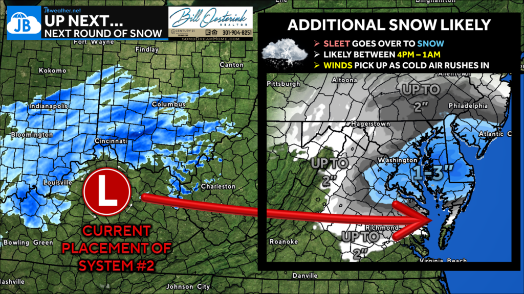
We have seen a widespread 5-8″ of #SNOW across the region this morning. While some are seeing sleet right now, we should see the precip come to an end by lunchtime. The afternoon may be very quiet, which makes for good shoveling time! Our Round 2 snow looks likely between 4pm-1am.

Right now, our second “upper level” system sits out in the Ohio Valley, where light snow is falling. As this system races eastward, we will see another round of light snow overspread the area. A general 1-3″ of additional snow is possible with this before it moves out.
This additional snow will put many areas between 6-9″+ in Southern Maryland as a storm total. This is slightly more than the 4-8″ I called for. This morning’s round of snow definitely produced more than I was expecting, as that sleet waited a bit before moving northward!
We live & we learn! Regardless, the forecast of high impacts remains, & I would expect snow-covered roads throughout the day. We’ll see the winds pick up with this secondary system, which will help cause blowing/drifting snow. Isolated outages are possible with gusts of 25-35mph.
Stay with JB Weather for the latest information on impacts here in Southern Maryland and across the Mid-Atlantic. You can always access my forecasts and updates here on the website, on Facebook, on Twitter, on Instagram, and on YouTube. JB Weather is the Mid-Atlantic’s Weather Leader, and I am working around the clock to keep you ahead of any storm!

Buying. Selling. Investing. Ready when you’re ready! Check out www.somdDreamHome.com today!

