Brought to you by Chesapeake Ice
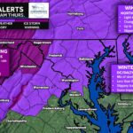
A wintry mix moves in after sunset tomorrow and transitions to rain before exiting by lunchtime. Areas northwest of I-95 will see the highest impacts with prolonged icing totaling over 1/4″. Hazardous travel with widespread impacts there. Lighter impacts southeast of I-95, where the ice will change to rain much sooner.

Stay with JB Weather for the latest information on impacts here in Southern Maryland and across the Mid-Atlantic. You can always access my forecasts and updates here on the website, on Facebook, on Twitter, on Instagram, and on YouTube. JB Weather is the Mid-Atlantic’s Weather Leader, and I am working around the clock to keep you ahead of any storm!

Chesapeake Ice is your local Ice Distributor and Manufacture for Southern Maryland. Please contact us now for your summertime Ice and Canned Artisan Water needs. Please check out our Facebook and website (chesapeakeice.net)

