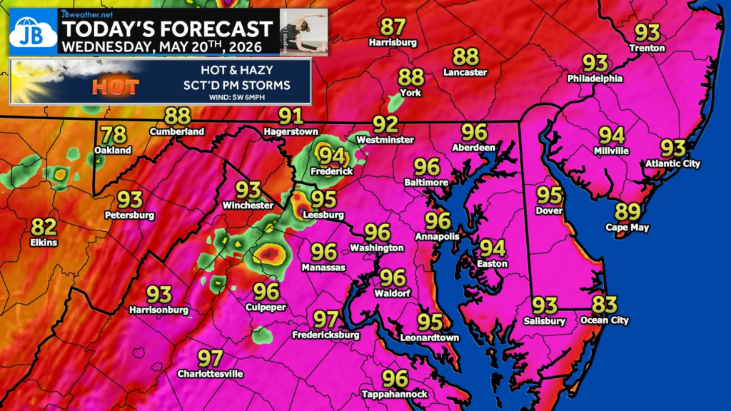
Another hot one is in store for today with temps reaching back into the middle 90s! A cold front will begin to start pressing eastward, though. As it does so, scattered showers and storms will begin to develop. These are the most likely west of I-95 this afternoon before moving east as evening progresses!
Stay with JB Weather for the latest information on impacts here in Southern Maryland and across the Mid-Atlantic. You can always access my forecasts and updates here on the website, on Facebook, on Twitter, on Instagram, and on YouTube. JB Weather is the Mid-Atlantic’s Weather Leader, and I am working around the clock to keep you ahead of any storm!
John Bordash
View More PostsJB Weather forecaster John Bordash is working around the clock to provide Southern Maryland, and neighboring communities, with accurate and reliable weather information.