Brought to you by Bill Oosterink, Realtor
In a rare move, the Storm Prediction Center has upgraded our region to a Level 4 “Significant Risk” for severe weather on Monday. These outlooks are extremely uncommon in the Mid-Atlantic, typically occurring only once or twice per decade.
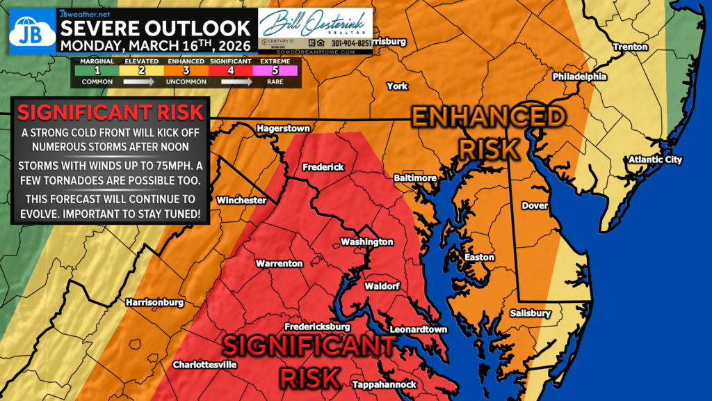
A strong cold front will move toward the region Monday afternoon. Earlier forecasts suggested storms might arrive a bit sooner, but the front now appears slightly slower, which could allow the atmosphere to destabilize more during the afternoon after morning showers move out.
If we see some clearing, temperatures and humidity will climb, creating more atmospheric energy for storms to tap into.
⏰ Timing to Watch
- After 12 PM: Scattered storms may develop ahead of the main line
- 3–6 PM: Main line of severe storms moves through the region
If storms develop ahead of the main line, a few could rotate and attempt to produce tornadoes.
The main line of storms will likely bring the greatest widespread threat, with damaging wind gusts up to 75 mph possible within stronger storms. There will be a lot of wind energy in the atmosphere, which storms could tap into quickly.
What Could Limit the Threat
There are still ways this setup could weaken:
- If the cold front moves faster
- If morning rain and clouds linger longer, preventing the atmosphere from fully destabilizing
In the Mid-Atlantic, we are notorious for either of these scenarios occurring, which sometimes limits severe outbreaks.
What You Should Do
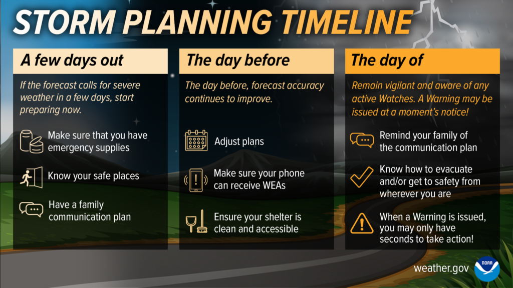
While there are still uncertainties, this is a setup worth taking seriously.
Make sure you have a severe weather plan in place, including:
- Knowing where you would go if warnings are issued
- Making sure you can receive weather alerts Monday afternoon
I’m not sharing this to scare anyone, but to make sure our community stays prepared and informed.
Stay with JB Weather for the latest information on impacts here in Southern Maryland and across the Mid-Atlantic. You can always access my forecasts and updates here on the website, on Facebook, on Twitter, on Instagram, and on YouTube. JB Weather is the Mid-Atlantic’s Weather Leader, and I am working around the clock to keep you ahead of any storm!
Brought to you by Bill Oosterink, Realtor. Buying. Selling. Investing. Ready when you’re ready! Check out www.somdDreamHome.com today!
John Bordash
View More PostsJB Weather forecaster John Bordash is working around the clock to provide Southern Maryland, and neighboring communities, with accurate and reliable weather information.