After a few much-needed showers this morning, especially across northern and western portions of the region, we’ll see conditions improve through midday with increasing sunshine and rapidly rising temperatures. By this afternoon, much of the area will be feeling summer-like with highs reaching the lower to middle 90s and heat index values pushing into the mid-90s to near 100°.
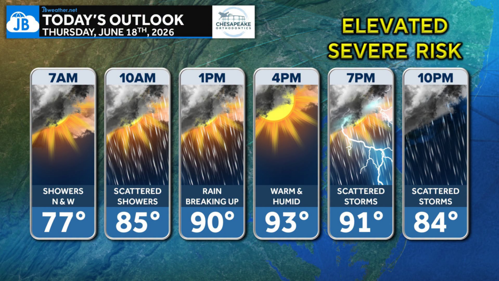
As the heat and humidity build ahead of an approaching cold front, scattered thunderstorms are expected to develop later today and continue into this evening. Not everyone will see rain, but if storms develop in your area, they could become strong. We’ll have a separate post later today focusing specifically on the severe weather potential and any updates from the Storm Prediction Center.
🌦️ Today’s Headlines:
• A few morning showers, mainly north and west, fade through midday.
• Hot and humid this afternoon with temperatures climbing into the 90s.
• Scattered thunderstorms develop later today and this evening.
• Cooler and less humid air arrives for Friday behind the cold front.
📍Southern Maryland and the lower Delmarva will likely stay dry through much of the day before the best chance for storms arrives during the late afternoon and evening hours.
Stay weather-aware today and check back later for a more detailed severe weather update. Stay with JB Weather for the latest information on impacts here in Southern Maryland and across the Mid-Atlantic. You can always access my forecasts and updates here on the website, on Facebook, on Twitter, on Instagram, and on YouTube. JB Weather is the Mid-Atlantic’s Weather Leader, and I am working around the clock to keep you ahead of any storm!
John Bordash
View More PostsJB Weather forecaster John Bordash is working around the clock to provide Southern Maryland, and neighboring communities, with accurate and reliable weather information.