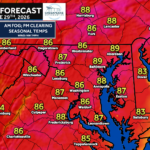
While we’re still focused on this weekend’s unsettled weather, confidence is growing that a significant heat wave could develop across the Mid-Atlantic during the first week of July.
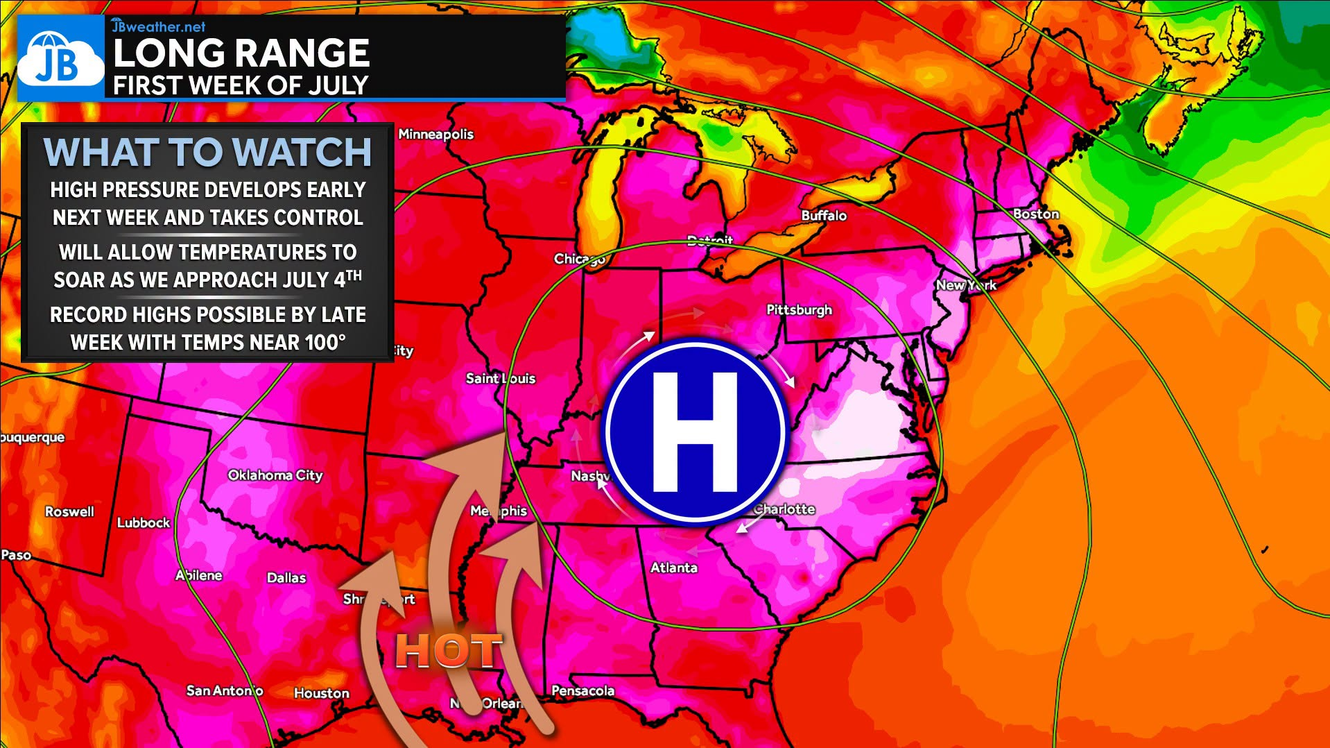
🌡️ A strong area of high pressure is forecast to build over the eastern United States beginning early next week, allowing temperatures to climb several degrees each day.
By Wednesday through Friday, many locations could see afternoon highs in the upper 90s to near 100°, with humidity pushing heat index values between 102° and 107°. A few of the hottest urban locations could briefly approach 110° during the peak of the heat.
🌙 Unfortunately, this won’t just be a daytime event. Warm, muggy nights with temperatures only falling into the 70s will provide very little overnight relief, increasing the risk for heat-related illnesses.
⚠️ While confidence is high that next week turns much hotter, there are still questions about just how intense the heat becomes. Small shifts in the position of the upper-level ridge or the development of afternoon thunderstorms could make a noticeable difference in temperatures.
⛈️ Looking toward Independence Day, the combination of extreme heat and increasing humidity may eventually fuel scattered thunderstorms. Historically, prolonged summer heat waves often end with a cold front and stronger thunderstorms, and some longer-range guidance hints that this could happen sometime around the July 3rd-4th timeframe. That part of the forecast remains uncertain, but it’s something we’ll be watching closely over the coming days.
John Bordash
View More PostsJB Weather forecaster John Bordash is working around the clock to provide Southern Maryland, and neighboring communities, with accurate and reliable weather information.