A stationary front remains draped across the region, and while storm coverage will be much lower than yesterday, scattered showers and thunderstorms are expected to develop through the afternoon and evening.
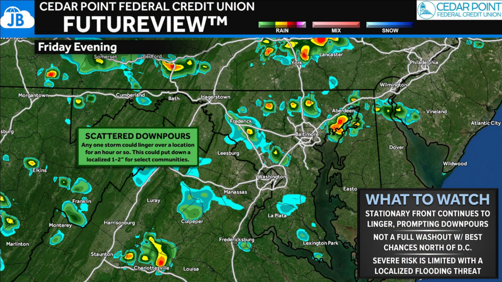
Not everyone will see rain today. The best chance for showers and storms will be north of DC. Most of the evening will feature dry periods with intervals of sunshine.
With any downpour that builds, it could produce strong, damaging wind gusts, especially where sunshine allows temperatures to climb. Any storm that stalls could quickly drop 1-2″ of rain in an hour, leading to localized flooding despite the lower storm coverage.
Unlike yesterday, today’s storms should be more isolated rather than organized into large clusters, but don’t let your guard down. It only takes one slow-moving storm to cause localized flooding or one stronger cell to produce damaging winds.
Stay with JB Weather for the latest information on impacts here in Southern Maryland and across the Mid-Atlantic. You can always access my forecasts and updates here on the website, on Facebook, on Twitter, on Instagram, and on YouTube. JB Weather is the Mid-Atlantic’s Weather Leader, and I am working around the clock to keep you ahead of any storm!

John Bordash
View More PostsJB Weather forecaster John Bordash is working around the clock to provide Southern Maryland, and neighboring communities, with accurate and reliable weather information.