Brought to you by Berkshire Hathaway HomeServices McNeils Group Properties
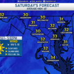
After our light snow event early Friday morning, we have seen rather cold temperatures settle in across the Mid-Atlantic. Many spots locally struggled to get to freezing both on Friday and on Saturday. We will see another cold front work through the region on Sunday, but not before a brief one-day warm-up. Due to that warm-up, we will see rain move across the region throughout the day on Sunday, but some freezing rain may be possible for a few hours on Sunday morning northwest of I-95.
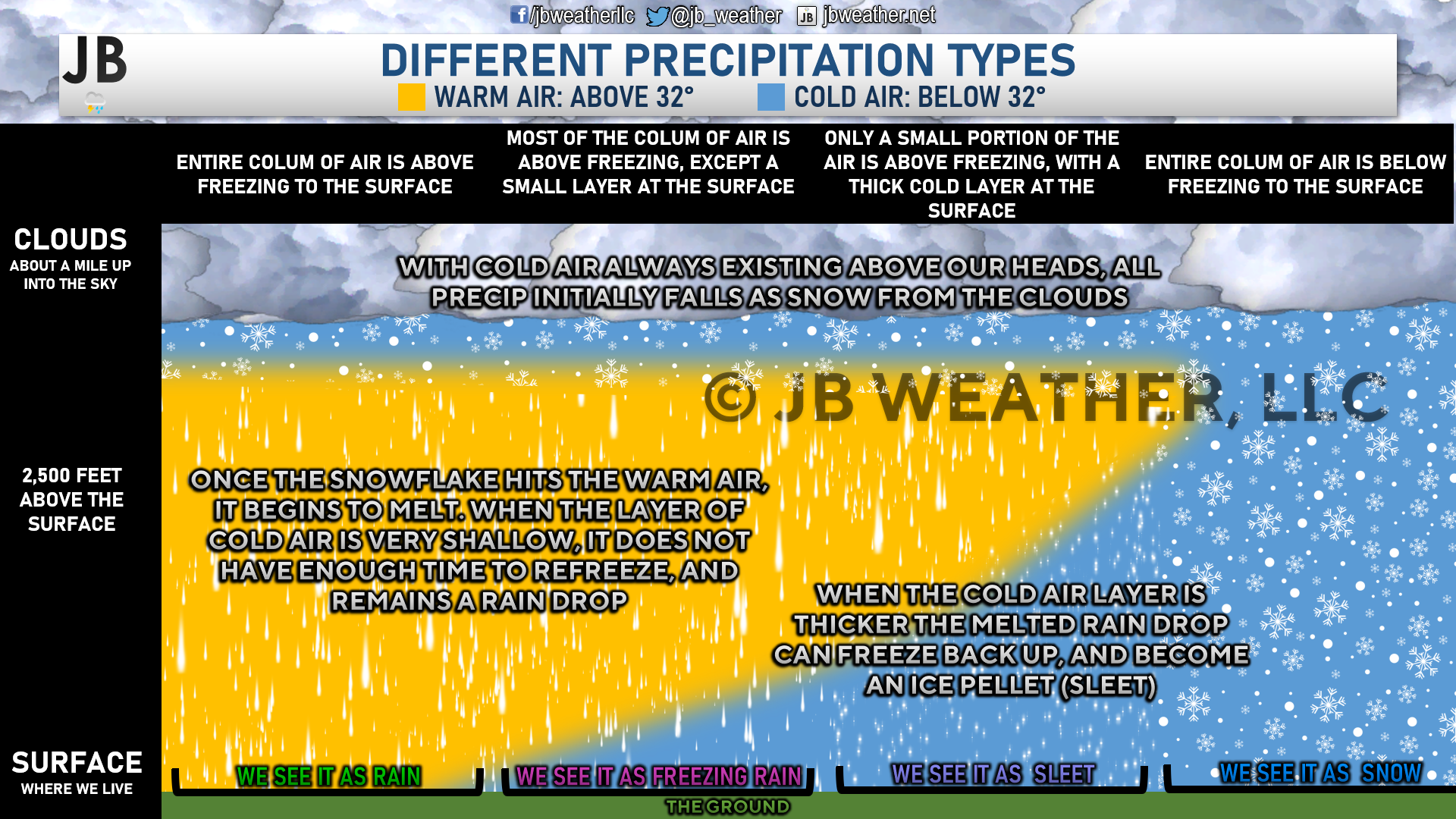
Freezing rain happens when temperatures are at or below freezing here at the surface, but there is a large column of air above our heads that is above freezing. This allows for the snowflakes that initially fly from the base of the clouds to melt into raindrops. However, there is not enough cold air below that warm air layer to refreeze the rain droplets, so they fall to the surface as liquid. However, the freezing cold surfaces lead to that liquid freezing on contact.
Timing
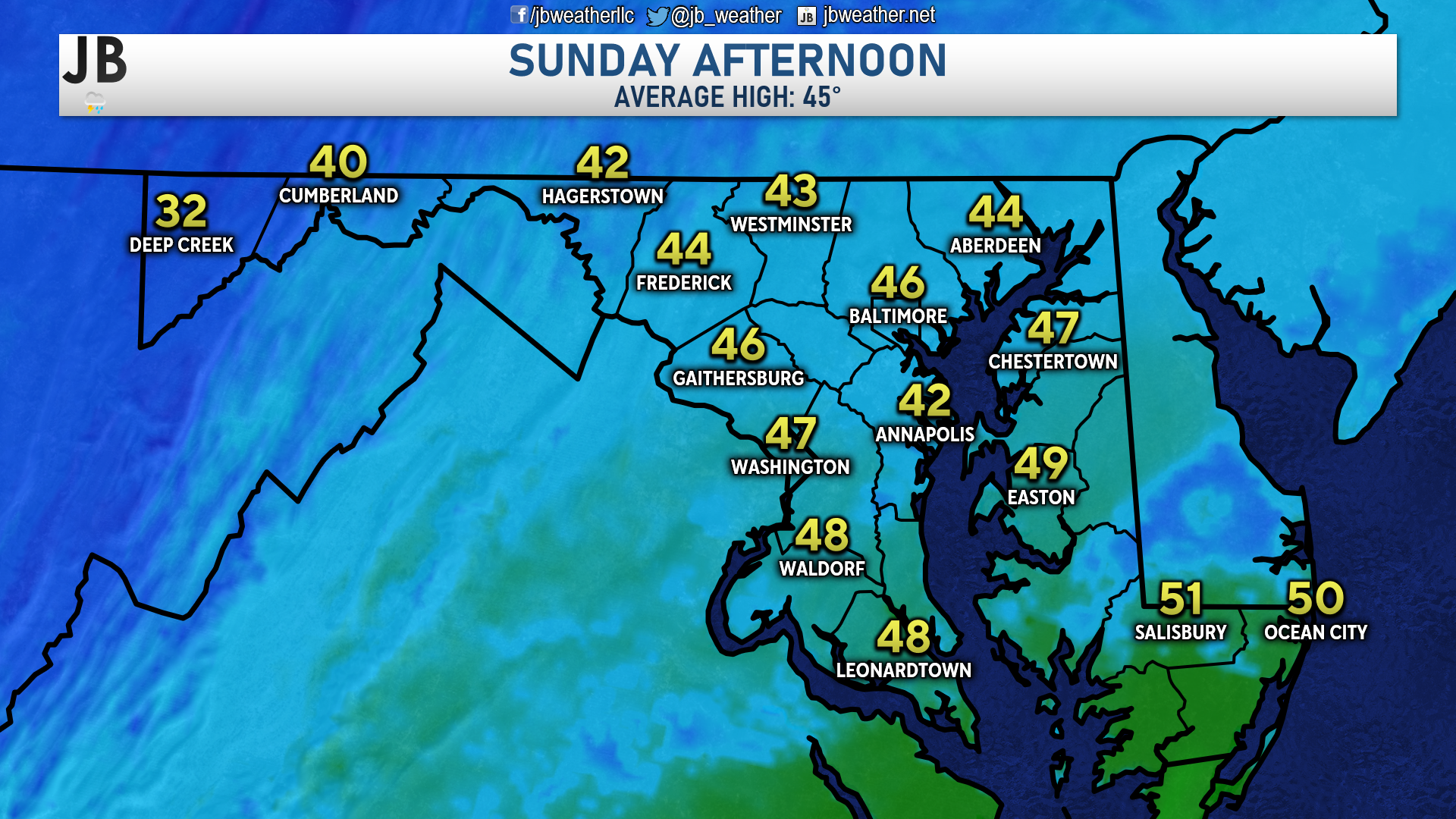
Futurecast shows precip beginning to move into the region early Sunday morning. Temperatures northwest of I-95, are likely to be below freezing before noon, which should allow any rain that falls up that way to be freezing rain. The coldest valleys and ridge tops are likely to see the freezing rain out of this. Areas southeast of I-95 are likely to see mainly rain. The entire region will warm up throughout the day though. As shown below, many spots are likely to top out in the 40s, to near 50°, Sunday afternoon.
Accumulation Map
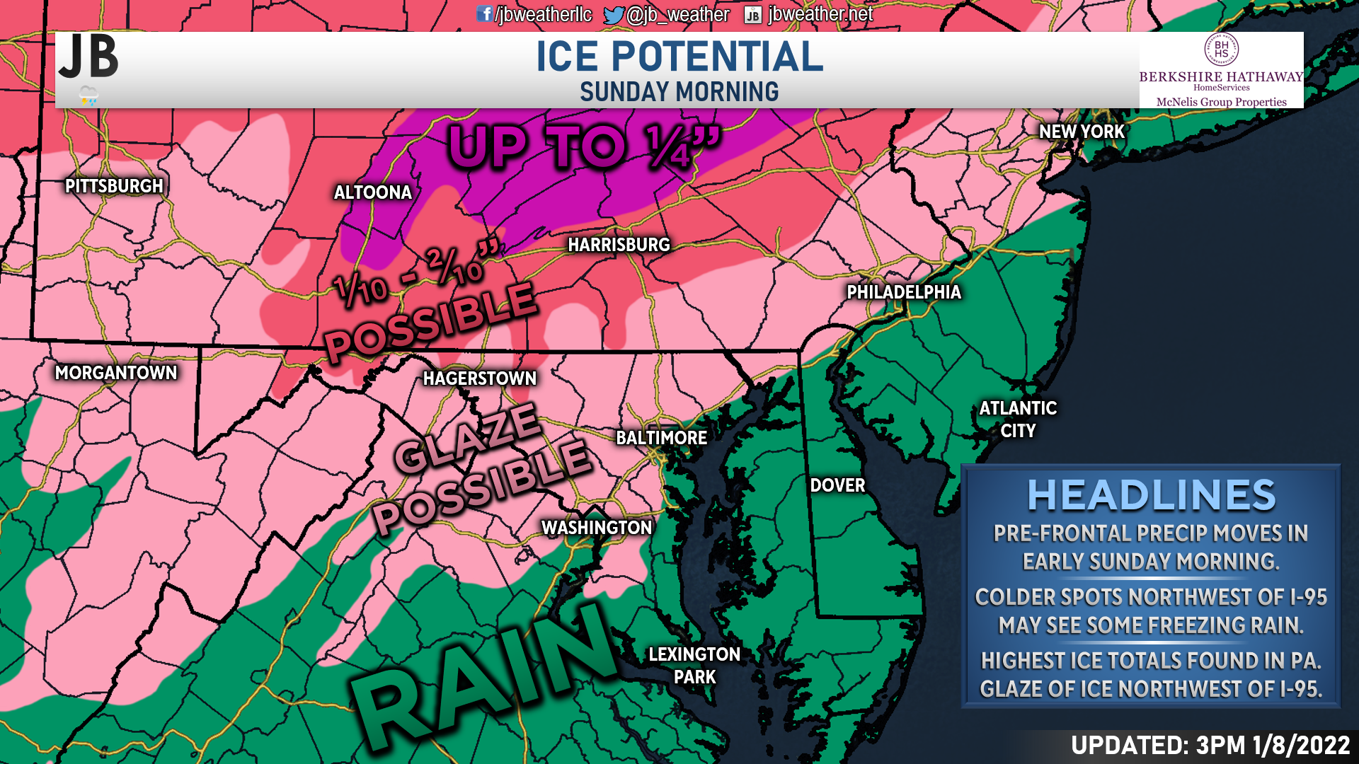
Spots northwest of I-95 may pick up a glaze to a tenth of an inch of ice out of this event. Locally, we may see the colder, hillier spots of Prince Geroge’s and Charles Counties pick up a brief bout of freezing rain if the temperatures are cold enough. The higher ice amounts of a tenth to two-tenths of an inch of ice will be found north of the Mason Dixon line. Locally higher totals, around a quarter-inch of ice, may be found in the ridge tops of central and eastern Pennsylvania.
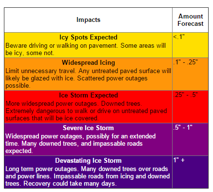
As seen on the chart to the right, more widespread impacts are not felt until there is over a tenth of an inch of ice. However, some slick spots are possible with just a glaze of ice.
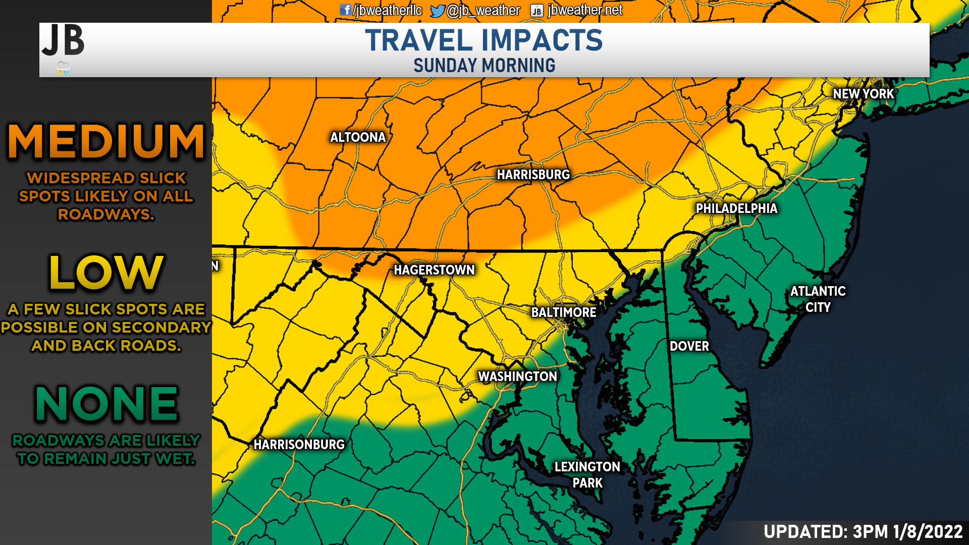
With this in mind, the National Weather Service has issued a Winter Weather Advisory for many areas northwest of I-95 for Sunday morning.

It is important to keep this in mind if you have any travel plans that take you to the advisory area. Some travel impacts are expected in that region with some slick spots forming, especially on back roads. More moderate impacts can be expected across Pennsylvania where higher ice totals are possible.
Rain Threat
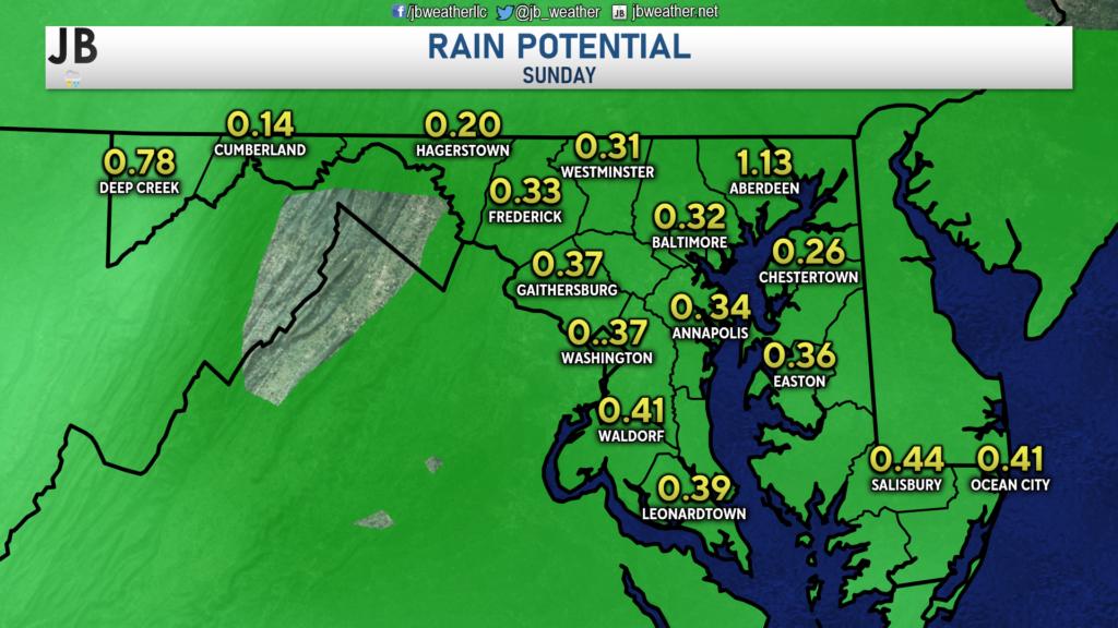
Southeast of I-95, temperatures will likely be warm enough to spare us from the freezing rain threat. However, we are on tap to see between a third and a half-inch of rain tomorrow. Much of this will fall during the afternoon hours, with more moderate rain being possible during the evening hours. This cold rain will not be fun, so it may be a good idea to just stay in tomorrow evening!
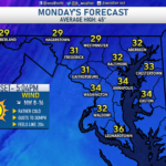
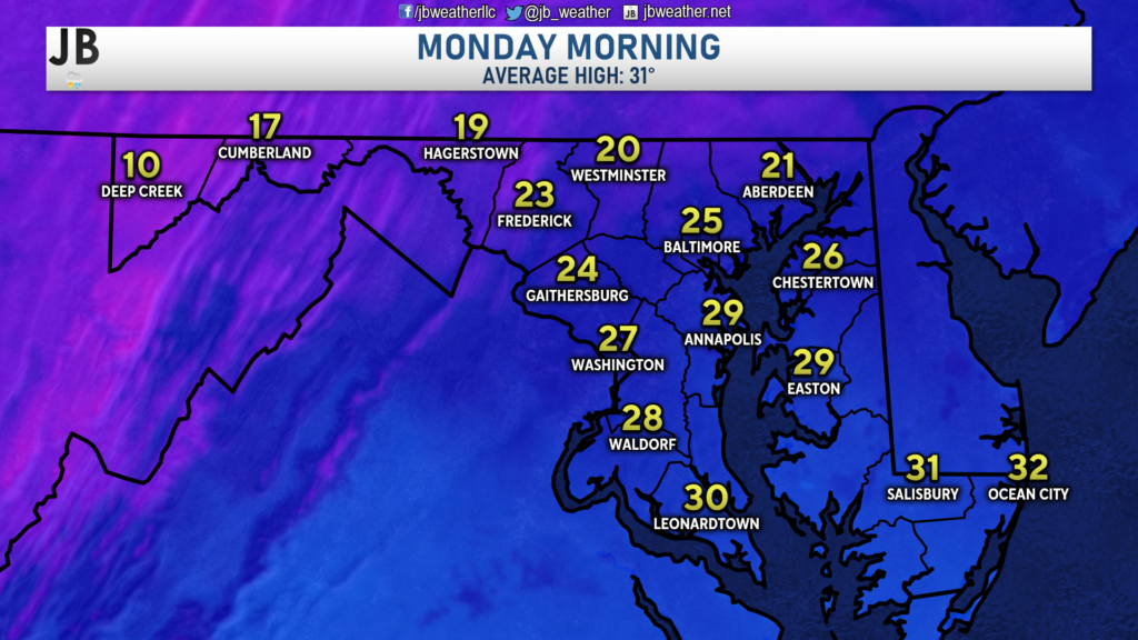
Cold air will rush in behind the front. If the incoming wave of cold air can filter in quickly enough, we could see the rain end as some sleet or light snow overnight. There likely would not be a lot of winter weather though, with no accumulation expected. Nevertheless, the cold air could lead to some slick spots forming via a refreeze overnight. As shown below, temperatures Monday morning look to get down into the 20s for most.
Stay with JB Weather for the latest weather information in Southern Maryland. You can always access my forecasts and updates here on the website, on Facebook, on Twitter, and on YouTube. JB Weather is Southern Maryland’s Weather Leader, and I am working around the clock to keep you ahead of any storm!
-JB
Real Estate now! Not sure where to start? View our Southern Maryland inventory of homes, land, farms and commercial properties on mcnelisgroup.com. Engage with our planning tools to determine your next real estate lifestyle decision, choose your realtor as a trusted advisor. Experience the difference with service and support from real estate’s forever brand!
John Bordash
View More PostsJB Weather forecaster John Bordash is working around the clock to provide Southern Maryland, and neighboring communities, with accurate and reliable weather information.