Brought to you by Chesapeake Orthodontics
Tropical Storm Ida developed in the Caribbean Sea today and is already garnering a lot of attention. This is because the future of Ida will likely take it as a strengthening hurricane in the Gulf Coast likely on Sunday. Ida is likely to become a big story, and there are a lot of things to discuss with this storm. Let’s start with the overall track.
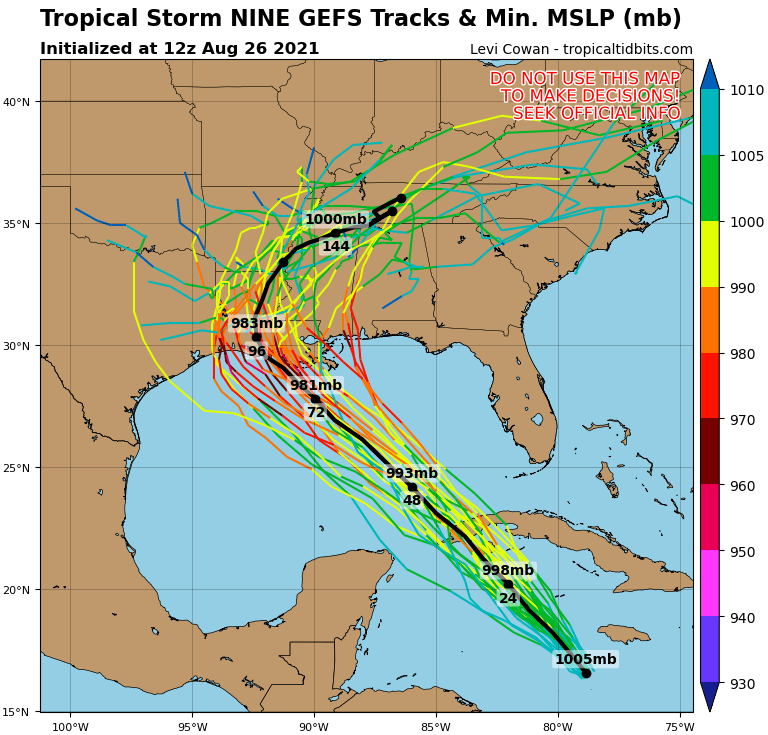
The track with Ida seems to be pretty straightforward. A high pressure centered over the Carolina’s will help impose a northwesterly steering flow on the storm. This should help guide Ida into the Gulf over the next day or day and a half. From there, Ida will traverse the Gulf and eventually make landfall along the Central Gulf Coast. The exact area for landfall is still a bit fuzzy. When the storm makes a more north-northwest turn will be important to whether this takes a more western or a more eastern track. A more western track would potentially put landfall near Lake Charles, LA, and western LA. An eastern landfall could take the storm closer to Biloxi, MS. This discrepancy will have big impacts, so we have our work cut out for us in determining where landfall will be. The National Hurricane Center currently cuts the difference between those two and places landfall around the mouth of the Mississippi River. Shown below are some of our computer models showing potential tracks for the storm. This shows the range of possibilities we could be facing.
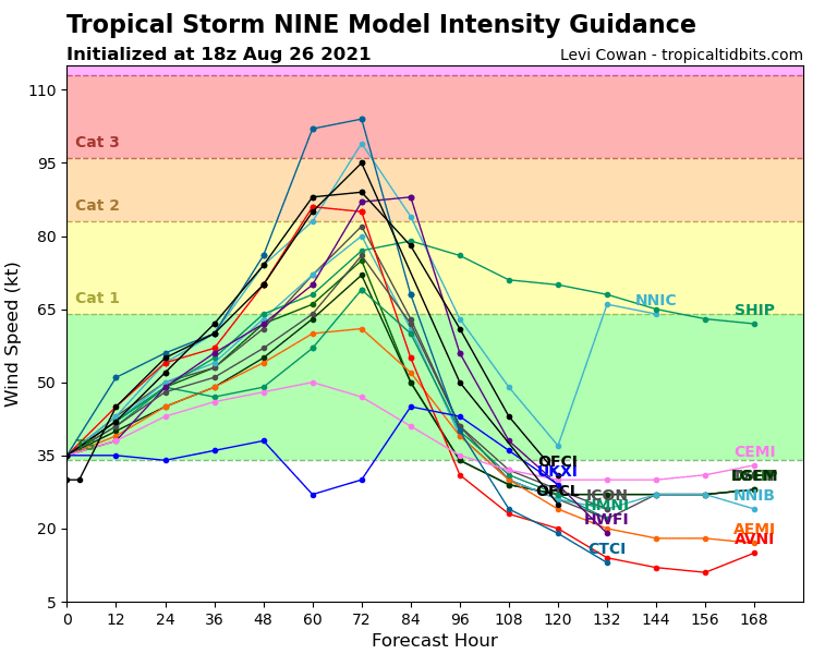
Intensity is also something we will need to look at. Ida has been gradually strengthening and is already a tropical storm. Once Ida gets into the Gulf of Mexico, it is very possible that this storm rapidly intensifies. Warm Gulf waters and light wind shear could allow for Ida to quickly intensify into a major storm. Shown below are our models depicting the range of possibilities in the storm’s strength. Many of our models take this storm very quickly up to hurricane strength. With enough time over water, we could see Ida achieve Major Hurricane status (CAT 3 or higher). The intensity of the storm will rely heavily on the storm’s ability to tap into these favorable atmospheric conditions.
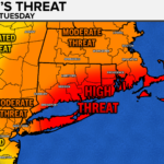
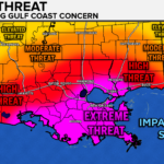
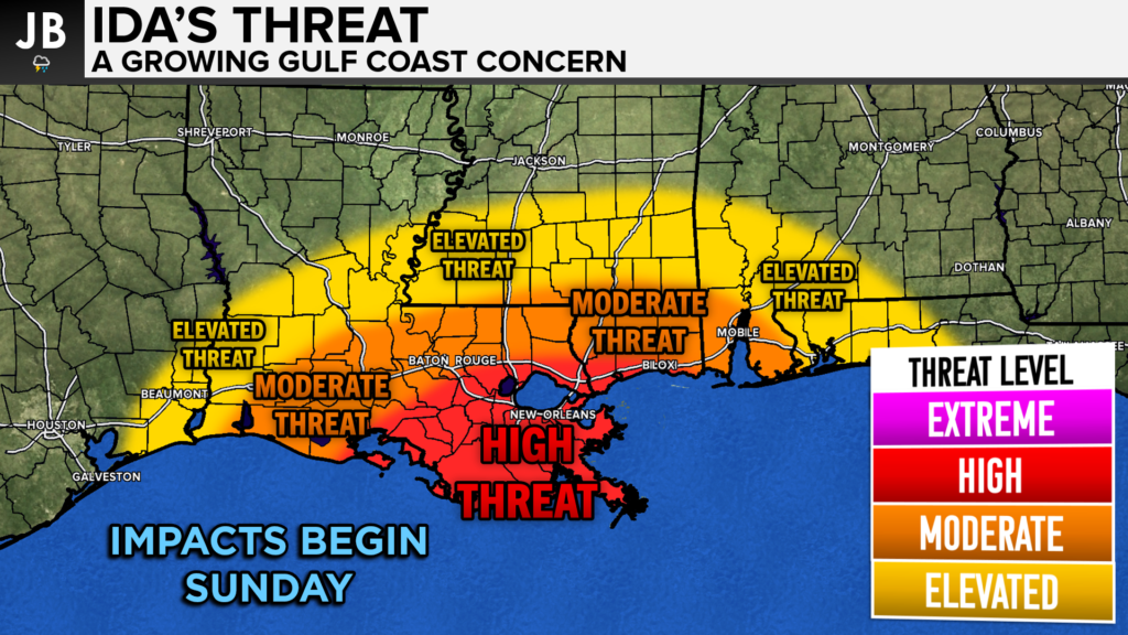
Right now, I think that Ida poses a high threat to much of coastal Lousiana. Landfall appears as it may happen on Sunday, which gives very little time for preparations ahead of the storm. Impacts may be felt as far away as eastern TX and western FL, so everyone will need to be on guard. The extent of impacts from this storm will depend on the exact landfall point. Wherever this storm comes ashore I would expect heavy rain, potentially 4-8″+, damaging winds of hurricane strength, a storm surge of several feet, and widespread power outages. This could be one of the more impactful landfalls in this region in just about 15 years/
It will be important to stay with JB Weather for the latest information on Ida and the potential impacts along across the Gulf Coast. You can always access my forecasts and updates here on the website, on Facebook, on Twitter, and on YouTube. JB Weather is Southern Maryland’s Weather Leader, and I am working around the clock to keep you ahead of the storm!
-JB
Dr. Thomas Hao and Dr. Dylan Schneider offer comprehensive orthodontic services for all ages. Schedule your free consultation today. Visit www.SOMDBraces.com today for more information!
John Bordash
View More PostsJB Weather forecaster John Bordash is working around the clock to provide Southern Maryland, and neighboring communities, with accurate and reliable weather information.