The Atlantic hurricane season officially begins on Wednesday, June 1st. And almost right on cue, it looks like we have some tropical trouble to pay attention to off of the shores of Mexico throughout the upcoming week!
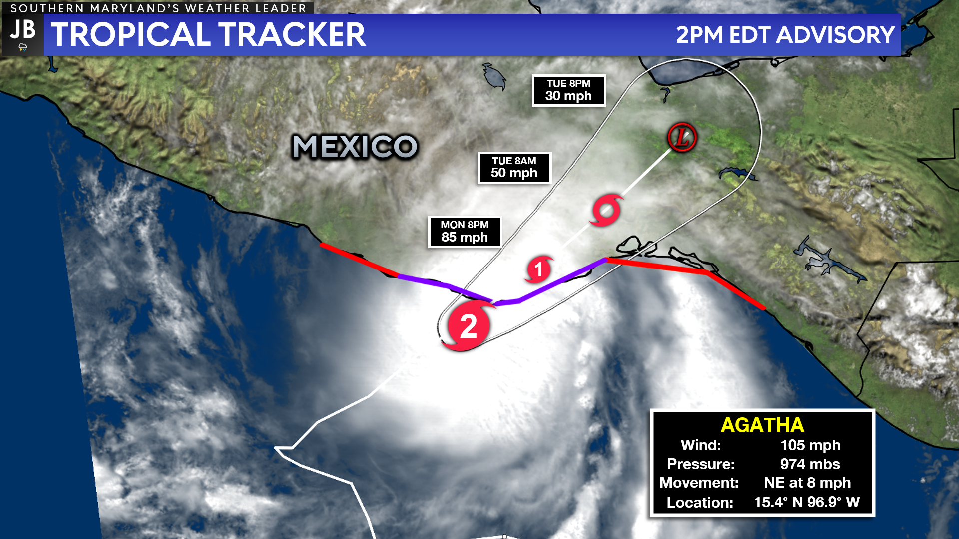
Last week, the first tropical system of the Pacific hurricane season developed and was named Agatha. Agatha has rapidly intensified into a Category 2 hurricane over the holiday weekend. Agatha is now on the verge of making landfall in southwestern Mexico, bringing heavy rain and damaging winds to that region.
After landfall, Agatha will continue her northeasterly movement across the southern tier of Mexico. The tall mountains in this region will help to quickly weaken Agatha from the monster Category 2 storm she is right now to a far weaker remnant low by Tuesday afternoon.
All of this is important because the future of Agatha after Tuesday, once she has made landfall, is unknown and is of interest to us in the Atlantic basin.
As I eluded to earlier, after landfall, Agatha will continue northeast and quickly dissipate into a remnant low over southern Mexico. The energy associated will dance around southern Mexico before finally moving northeast over either the southern Gulf of Mexico or the northwestern Caribbean.
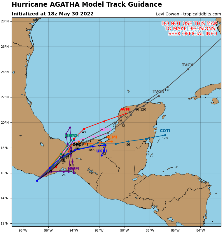
If Agatha’s remnant energy is, indeed, able to remerge over the open waters of the Gulf or Caribbean, then we could see a new tropical system develop. Generally speaking, the atmospheric pattern would be somewhat conducive for this to happen by late this week.
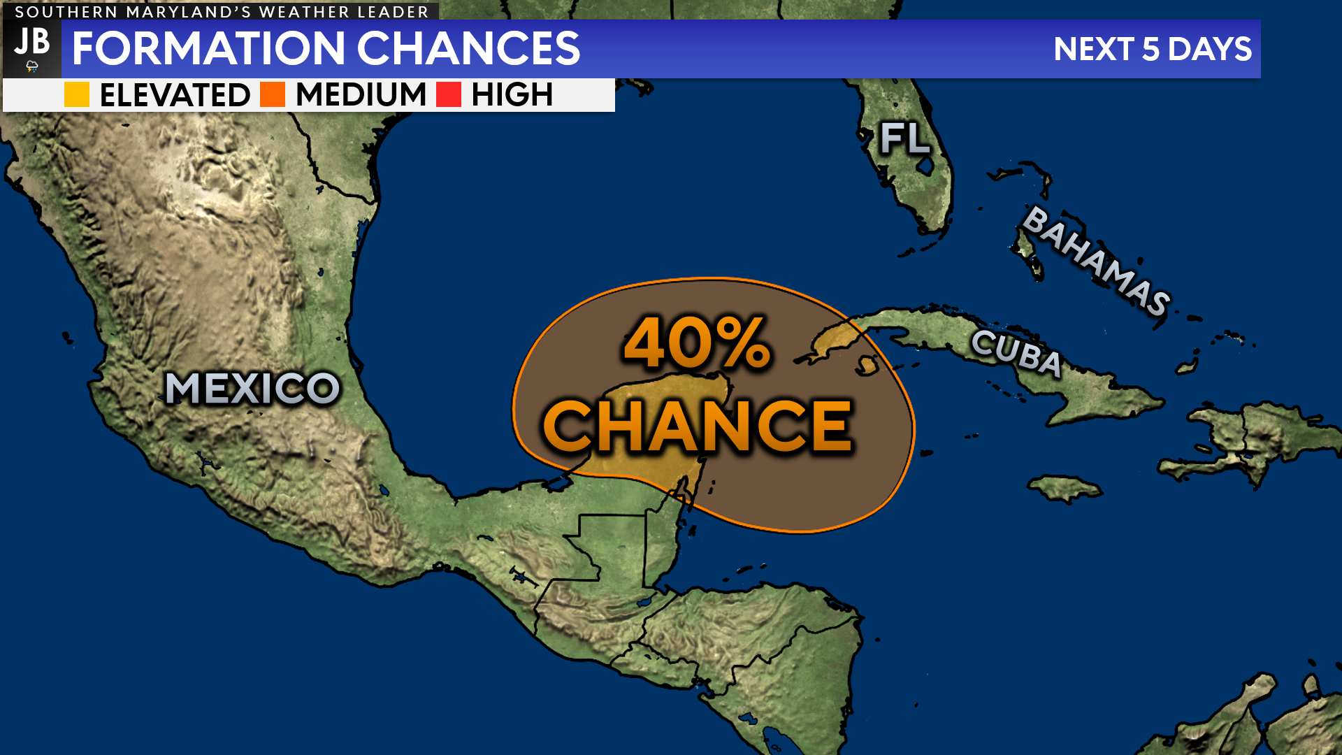
Sure enough, the National Hurricane Center is already monitoring for this potential to occur. They are currently highlighting the area around the Yucatán Peninsula as having a 40% chance of seeing some sort of tropical cyclone formation over the next 5 days.
If we were to see a new named storm develop in either the Gulf or the Caribbean, the system would earn the name “Alex”, the first name on our 2022 tropical cyclone list.
If we were to see “Alex” form, it is unclear where the storm would track, how strong it would be, or what the potential impacts to land could look like. This is unsurprising as we are now talking about what a system, that has yet to form, would do in 7-10 days. Our modeling has been all over the place with the potential threat, deeming them as being unreliable at this stage.
It will be important to watch and see what happens over this week. There is no guarantee that a storm would redevelop in the Gulf or Caribbean, or that it would affect land (especially our part of the world). I will continue to keep an eye on this potential and provide updates as needed.
One thing is clear, we are definitely entering hurricane season!
Stay with JB Weather for the latest information on Southern Maryland weather. You can always access my forecasts and updates here on the website, on Facebook, on Twitter, on Instagram, and on YouTube.
-JB
John Bordash
View More PostsJB Weather forecaster John Bordash is working around the clock to provide Southern Maryland, and neighboring communities, with accurate and reliable weather information.