System Near Bahamas Could Become Imelda; Track Still Uncertain
Two tropical systems in play this week, with questions about whether Humberto will steer Imelda out to sea or leave her behind near the U.S. coast.
Erin stays offshore, but onshore winds will bring coastal flooding and rough surf today.
Onshore flow will bring coastal flooding, higher waves, and breezy winds.
Erin remains a powerful storm but will curve out to sea, keeping direct U.S. impacts low.
Erin is expected to strengthen as it moves west, but long-term guidance depends heavily on high pressure to its north.
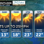
Brought to you by Chesapeake Orthodontics We have a windy day on tap as northwesterly breezes bring in a one-day cool down. Wind gusts up […]
Brought to you by Bill Oosterink, Realtor A cold front will approach the region from the west this afternoon. A line of severe storms may develop […]
Brought to you by Sonder Studios We are getting the work week off to a nice start! Mostly sunny skies and southerly winds will allow […]
Brought to you by Sonder Studios We have a seasonally cool day on tap, with many spots only maxing out in the 30s. The bigger story […]
Brought to you by Sonder Studios We have a chilly day on tap where temps may struggle to break freezing. This will help to keep slick […]

John Bordash was born and raised in Southern MD. Living in the region for most of his life, he knows that the region receives very limited weather coverage, especially when dangerous weather moves in. John created JB Weather to keep Southern Maryland communities informed and prepared. From the southernmost tip of St. Mary’s to the 301-corridor, John Bordash is keeping you ahead of the storm.