Brought to you by William Richmond Inc. Roofing & Siding
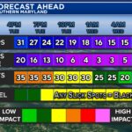
Our first snow of the season moved through yesterday and early this morning, and broke our 729-day snow drought! Our northern zones saw 3-6″ of snow, with the highest totals being reported just NW of I-95. Our southern zones also saw decent snow amounts, with many there seeing 1-3″. In the aftermath, slick spots have been left, which is leading to some hazardous travel.
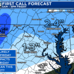
While some may be over the snow, we may have more snow on the way to close out the week. We will see a fresh injection of cold air arrive to the region tonight. This will supply the cold air and set the stage for our next system on Friday.
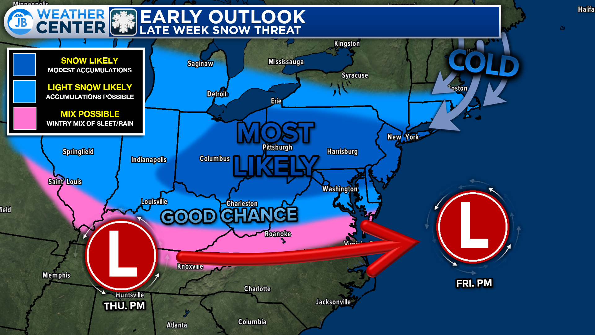
A rather weak area of low pressure will likely develop in the Midwest on Thursday and track eastward. On a track like this, we would expect a stripe of precip from the Ohio River Valley through the Mid-Atlantic. With cold air in place, this precip is likely to fall as snow for many.
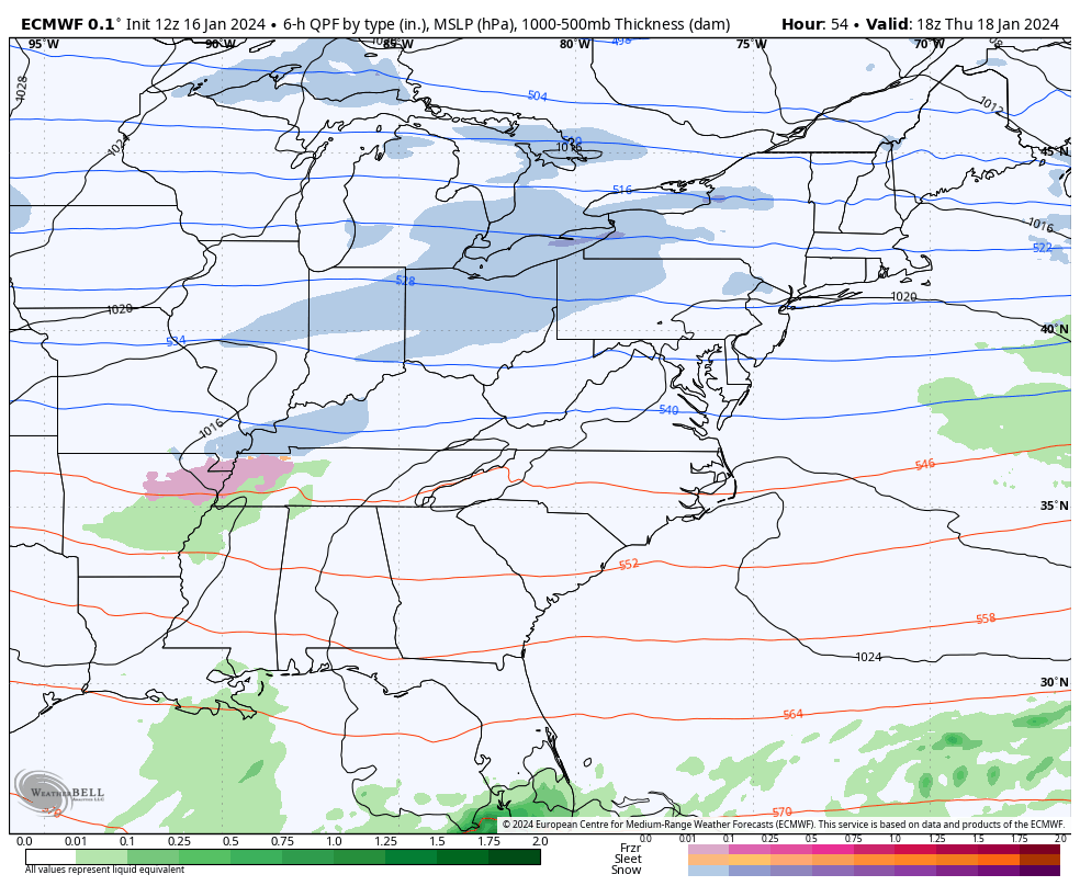
Our European model (shown above) plays this out quite well. This model shows light snow overspreading much of the Mid-Atlantic Thursday and Friday morning. Like with this past storm, the question is how much moisture will be present?
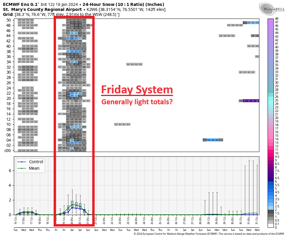
Most of our guidance favors overall light precip, which would keep snow totals down–potentially similar to what we saw last night. This is a look at the different models that make up the European model family. The good news is that they all do show snow for Friday–which is all we can look for this far out. While I would not latch on to totals, you can see that the general theme is for minor to modest amounts. Those details will begin to iron themselves out tomorrow.
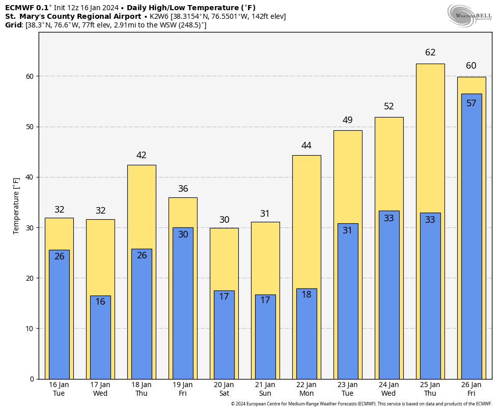
One thing is for certain, we are going to finish this week off on a cold note! The European model favors temperatures in the 30s through Sunday! We will see a mid-to-late January thaw take place next week though! It won’t be long-lasting, but it could provide some relief.
I will have more details on this threat tomorrow with my first call map on snow totals issued sometime tomorrow afternoon. Stay with JB Weather for the latest information on impacts here in Southern Maryland. You can always access my forecasts and updates here on the website, on Facebook, on Twitter, and on YouTube. JB Weather is Southern Maryland’s Weather Leader, and I am working around the clock to keep you ahead of any storm!
-JB

William Richmond Inc. is your trusted roofing and siding contractor in Southern Maryland. Our services include roof installation and repair, siding replacement, gutter installation and repair, and window replacement. Contact us today for quality workmanship and exceptional customer service.
John Bordash
View More PostsJB Weather forecaster John Bordash is working around the clock to provide Southern Maryland, and neighboring communities, with accurate and reliable weather information.