Brought to you by Cedar Point Federal Credit Union
After a dry few months, we have seen an increase in moisture across the Mid-Atlantic over the last month. Today, this increased moisture will lead to a notable severe risk after temperatures surge into the upper 80s and lower 90s with humidity. Today will feel like a typical mid-Summer day!
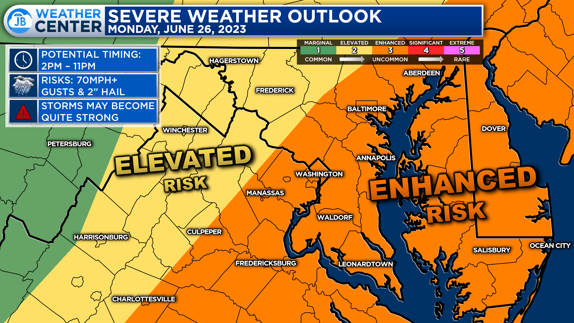
The severe risk will be the top headline for your Monday. The Storm Prediction Center has placed areas along and east of I-95 under a Level 3 “Enhanced Risk” of severe weather this afternoon and evening.
In the Mid-Atlantic, these Level 3 risks are only issued a handful of times yearly. So this uncommon classification speaks to our region’s increased threat of severe weather today.
This severe risk comes as a cold front pushes through our region this evening. Many areas will see warm and humid conditions today, which will allow for the atmosphere to become unstable and conducive for potential severe weather.
We will see a line of storms develop along I-81 by mid-afternoon. With clearing skies along I-95, we should see these storms strengthen as they push eastward. Futurecast shows that not everyone will see rain today, and the heaviest rains may be focused just north of our region.
With that said, all areas east of the mountains will have conditions that could support strong storms well into this evening.
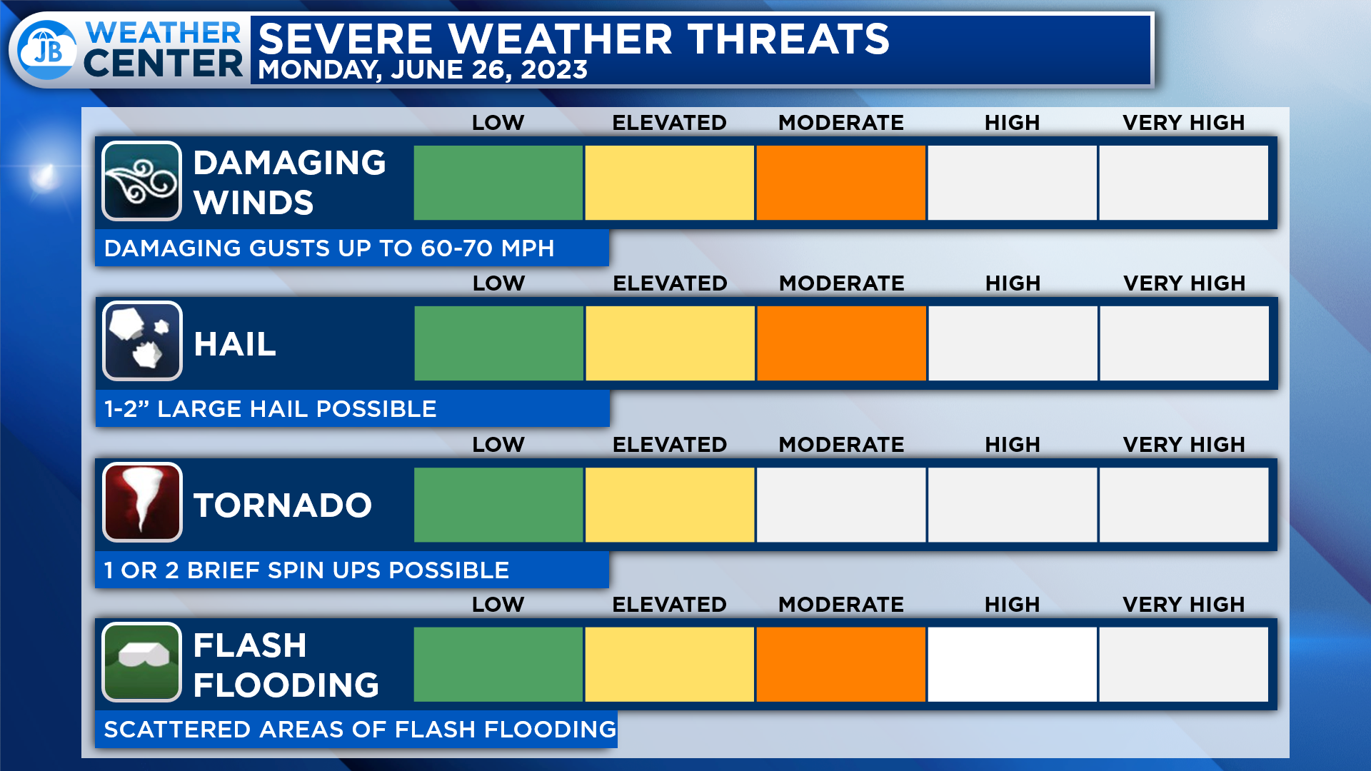
The primary severe weather risks today will come from the threat of damaging wind gusts of 60-70mph and hail that could approach 2″ in diameter. Flash flooding is another localized concern as some neighborhoods could see over an inch of rain where the strongest storms move through. While the tornado threat is not overly high today, it is elevated. I cannot rule out 1 or 2 brief spin-ups this afternoon, especially across Northern MD and Southern PA.
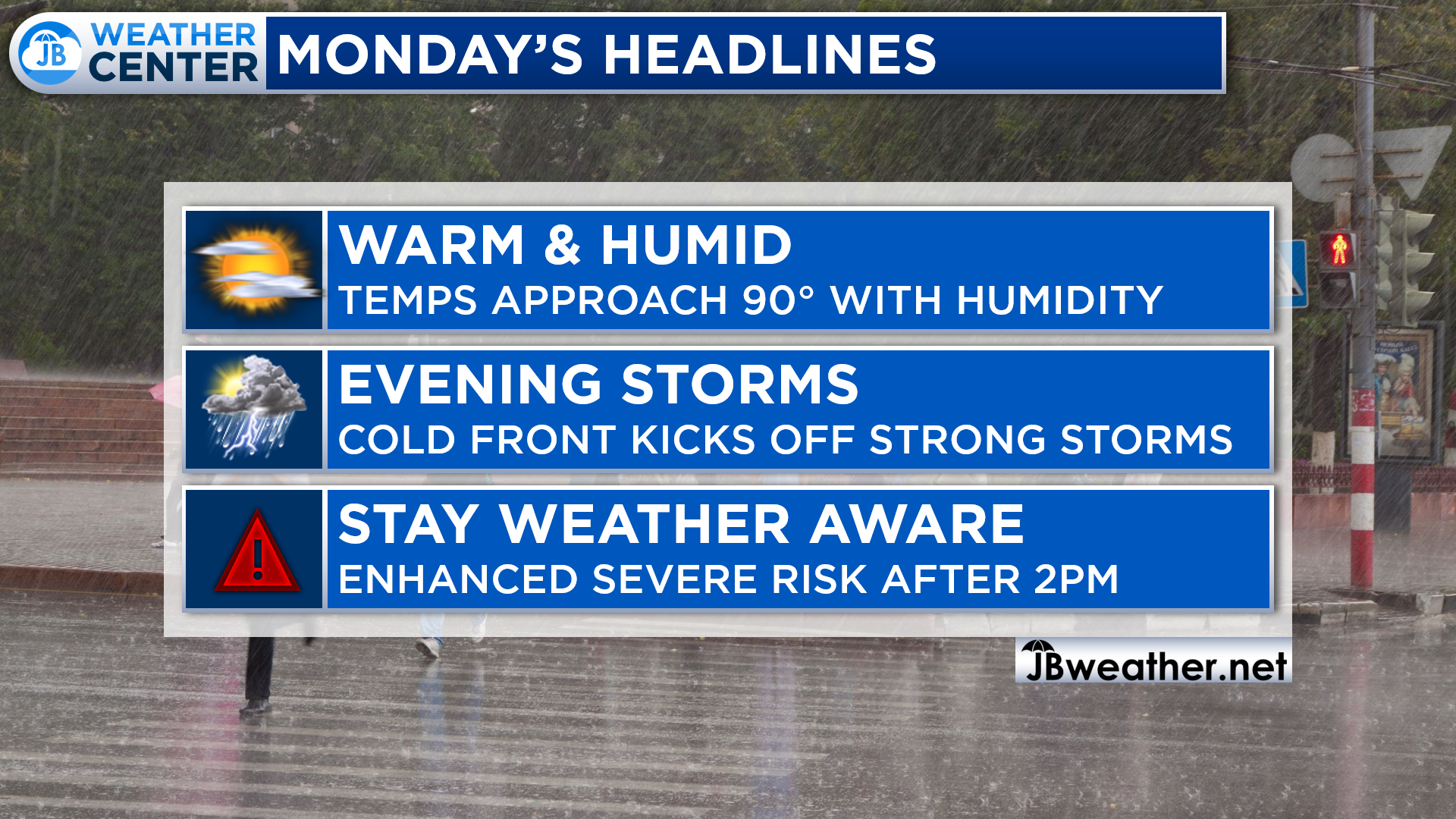
All-in-all, today looks to be an active day on multiple fronts. You will want to take it easy outside today as the heat and humidity today could make outdoor activity uncomfortable. That risk of severe weather begins to increase after 2PM and peaks between 5-10PM in Southern MD.
You must stay weather aware as weather warnings and watches will likely be issued today. Make sure you have a way to get those warnings and be prepared to take shelter if needed. I will be in the weather center throughout the day monitoring conditions and providing updates and coverage as needed!
Stay with JB Weather for the latest information on Southern Maryland weather. You can always access my forecasts and updates here on the website, on Facebook, on Twitter, on Instagram, and on YouTube.
-JB
Cedar Point has been providing trusted banking, lending and personal finance solutions to the Southern Maryland Community since 1945. Visit the credit union at any of its 6 locations in St. Mary’s, Charles and Calvert counties or online at www.cpfcu.com.
John Bordash
View More PostsJB Weather forecaster John Bordash is working around the clock to provide Southern Maryland, and neighboring communities, with accurate and reliable weather information.