

Forecast: Another Wintry Mix Possible NW of I-95
Our active pattern continues as our second system in 24-hours looks to bring a wintry mix to areas northwest of I-95.

Our active pattern continues as our second system in 24-hours looks to bring a wintry mix to areas northwest of I-95.
As our winter storm moves out, widespread impacts will continue to be felt today as leftover moisture trains through the region.
Brought to you by Chesapeake Ice Looking ahead to Wednesday, many school districts south of Baltimore are likely to be closed thanks to the lingering effects […]
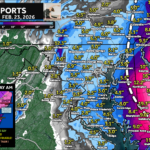
Our incoming winter storm will overspread snow across the Mid-Atlantic Tuesday afternoon with high impacts expected from snow and sleet.
Our latest winter storm is set to bring the chance of widespread, significant snowfall to the Mid-Atlantic Tuesday afternoon and evening.
Brought to you by Chesapeake Ice Before the Super Bowl starts, I wanted to alright y’all about the chance of some scattered flurries and snow […]
Brought to you by Sonder Studios Our region is set to see a winter storm bring moderate to high impacts Tuesday into Wednesday! With impactful […]
A winter storm will look to bring widespread impacts on Tuesday with as much as 4-8″ of snow accumulation being likely.
Brought to you by Chesapeake Orthodontics Lots of questions about the chances of winter weather with our third system! It does look like a system will, […]
