




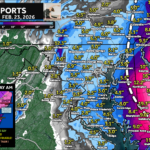





Increasing Odds of Early Week Winter Storm
Odds are increasing that modest snow/sleet will impact the Mid-Atlantic early next week with some details starting to come into focus.

A weak clipper system will look to bring a period of scattered snow showers to the Mid-Atlantic Friday afternoon.
After our cold settles in late this week, we will see a system move east out of the Great Plains. There are several questions regarding […]
As we have talked about, we are going to see a flip to a much colder pattern for (at least) the first half of January. […]
Our wet pattern with mild temps is likely to stick around to close out 2024. However, we are likely to see our pattern flip back […]
My first #SNOW map of the season! We have a system developing off the coast that will “retrograde” (move backward) over the Northeast. As that […]
Brought to you by William Richmond Inc. Roofing & Siding Our storm system is trending to the south, which means a forecast update is necessary! […]
A pre-Valentines Day rain-maker may end as accumulating snow for areas along and north of the Mason-Dixon Line as cold air moves in.
