Friday’s Forecast: Seasonable Today, Hazardous Cold Tonight
After a seasonable afternoon, dangerously cold wind chills arrive tonight under a Cold Weather Advisory.
Dangerous cold settles into the region Friday night ahead of the weekend winter storm.
A high-impact winter storm will bring heavy snow followed by sleet and freezing rain from Saturday night through Sunday, creating dangerous conditions and widespread impacts.
Confidence to continues to grow in a widespread, high-impact storm this weekend.
Forecast models continue to trend north, increasing the potential for significant winter weather across the Mid-Atlantic late Saturday night through early Monday.
Recent guidance shows a subtle northward trend that could increase Mid-Atlantic impacts. Details will continue to evolve over the coming days.
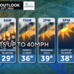
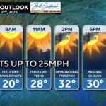
Today brings sunshine and blustery conditions with wind chills in the 30s.
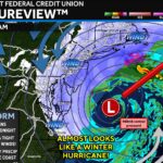
Forecast models continue to show a storm developing this weekend, but key differences in storm track and cold air placement remain.
Guidance still supports a weekend storm. Exact impacts and amounts will depend on the eventual track.
Gusty northwest winds are making today feel much colder than the actual temperature.

John Bordash was born and raised in Southern MD. Living in the region for most of his life, he knows that the region receives very limited weather coverage, especially when dangerous weather moves in. John created JB Weather to keep Southern Maryland communities informed and prepared. From the southernmost tip of St. Mary’s to the 301-corridor, John Bordash is keeping you ahead of the storm.